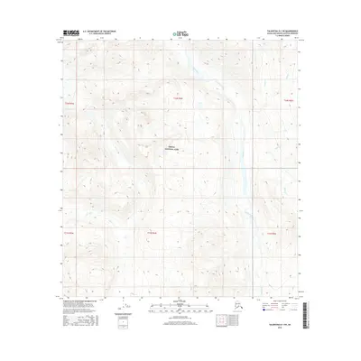
2016 Map of Talkeetna D-1 SW
USGS Topo · Published 2016About this map
Denali National Park encompasses a significant portion of this high-elevation landscape in the Matanuska-Susitna region, where complex glacial and fluvial systems dominate the terrain. The central hydrological feature is the Coffee River, which winds through the eastern half of the quadrangle, collecting drainage from several distinct mountain streams. These include Crystal Cr and Cloud Cr to the north, along with Spink Cr further south. On the western side of the survey area, the drainage pattern shifts toward Slide Cr and Alder Cr, indicating a rugged topography defined by sharp ridgelines and narrow valleys. This 2016 survey illustrates the pristine, undeveloped character of the Alaska Range interior, where legal land divisions like t32n r6w and t31n r6w provide the only structural framework over the wild landscape.
Find a feature on this map
13 named features on this map. Tap any name to fly to it.
Don’t see what you’re looking for? This feature index may not catch every label — zoom into the map to look around manually.
Map Details
Editions of this 2016 Talkeetna D-1 SW Map
This is the sole edition of this map. No revisions or reprints were ever made.
Other maps of this area

1950 · Talkeetna
USGS Topo · 1:250,000

1951 · Talkeetna
USGS Topo · 1:250,000

1951 · Talkeetna C-1
USGS Topo · 1:63,360

1958 · Talkeetna C-1
USGS Topo · 1:63,360

1958 · Talkeetna C-2
USGS Topo · 1:63,360

1958 · Talkeetna D-2
USGS Topo · 1:63,360
1958 · Talkeetna D-1
USGS Topo · 1:63,360

1958 · Talkeetna
USGS Topo · 1:250,000

1965 · Talkeetna
USGS Topo · 1:250,000
2014 · Talkeetna D-2 SE
USGS Topo · 1:25,000