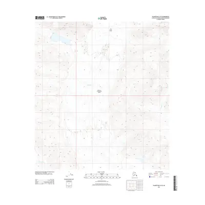
2014 Map of Talkeetna D-2 SE
USGS Topo · Published 2014About this map
Denali National Park encompasses this dramatic alpine landscape, defined by the massive ice flows of the Ruth Glacier and Tokositna Glacier. The topography is dominated by the narrow passage of The Great Gorge, where the ice is flanked by steep mountain walls. This 2014 survey documents the glacial extent and drainage patterns of the region, including the headwaters of Alder Cr and Whistler Cr. The map illustrates a wilderness area where natural geological forces, rather than human infrastructure, shape the terrain. It provides an essential record of the glacial environment within the Alaska Range, showing the intricate relationship between high-altitude snowfields and the carved valleys below.
Find a feature on this map
8 named features on this map. Tap any name to fly to it.
Don’t see what you’re looking for? This feature index may not catch every label — zoom into the map to look around manually.
Map Details
Editions of this 2014 Talkeetna D-2 SE Map
This is the sole edition of this map. No revisions or reprints were ever made.
Other maps of this area

1950 · Talkeetna
USGS Topo · 1:250,000

1951 · Talkeetna
USGS Topo · 1:250,000

1951 · Talkeetna C-1
USGS Topo · 1:63,360

1958 · Talkeetna C-1
USGS Topo · 1:63,360

1958 · Talkeetna C-2
USGS Topo · 1:63,360

1958 · Talkeetna D-2
USGS Topo · 1:63,360
1958 · Talkeetna D-1
USGS Topo · 1:63,360

1958 · Talkeetna
USGS Topo · 1:250,000

1965 · Talkeetna
USGS Topo · 1:250,000
2014 · Talkeetna D-2 SW
USGS Topo · 1:25,000