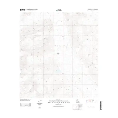
2014 Map of Talkeetna D-2 SW
USGS Topo · Published 2014About this map
Denali National Park encompasses the core of this landscape, where the shifting ice of the Tokositna Glacier and Kanikula Glacier defines the high-altitude topography. This 2014 survey by the United States Geological Survey illustrates a region of dynamic glacial activity and significant elevation changes within the Alaska-Matanuska-Susitna Borough. The map focuses on the natural hydrology and terrain of the western park interior, marking the intersection of Township 32 North and 31 North. This specific sheet provides high-resolution contour data for researchers monitoring glacial recession or mountaineers tracking the traditional routes through these massive ice fields.
Find a feature on this map
5 named features on this map. Tap any name to fly to it.
Don’t see what you’re looking for? This feature index may not catch every label — zoom into the map to look around manually.
Map Details
Editions of this 2014 Talkeetna D-2 SW Map
This is the sole edition of this map. No revisions or reprints were ever made.
Other maps of this area

1950 · Talkeetna
USGS Topo · 1:250,000

1951 · Talkeetna
USGS Topo · 1:250,000

1958 · Talkeetna C-2
USGS Topo · 1:63,360

1958 · Talkeetna D-2
USGS Topo · 1:63,360

1958 · Talkeetna C-3
USGS Topo · 1:63,360

1958 · Talkeetna D-3
USGS Topo · 1:63,360

1958 · Talkeetna
USGS Topo · 1:250,000

1965 · Talkeetna
USGS Topo · 1:250,000
2014 · Talkeetna C-2 NW
USGS Topo · 1:25,000
2014 · Talkeetna D-2 NW
USGS Topo · 1:25,000