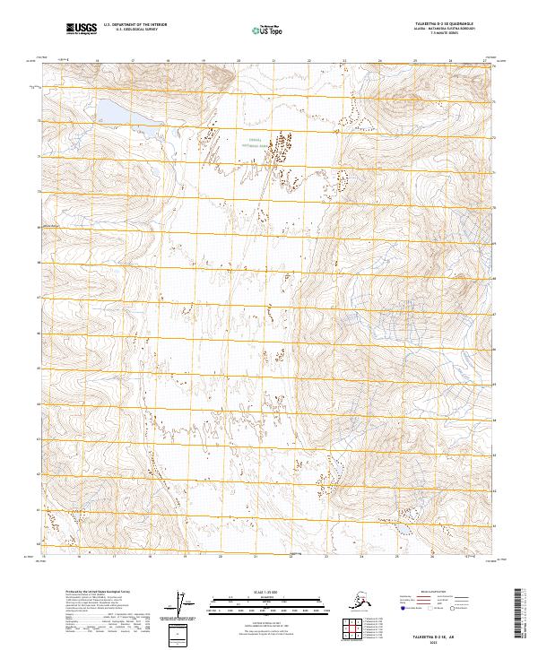
2023 Map of Talkeetna D-2 SE
USGS Topo · Published 2023About this map
Denali National Park encompasses a significant portion of this landscape, where the high-altitude terrain of the Alaska Range dictates the flow of glacial runoff. The drainage patterns are defined by the paths of Alder Creek and Whistler Creek, which carve through the south-central territory of the range. Surveyed by the U.S. Geological Survey, this map illustrates the immense scale of the Alaskan wilderness through eighty-foot contour intervals, revealing the complex ridges and glacial basins that characterize this protected interior. The cartography focuses on the natural topography of the Matanuska-Susitna region, detailing the elevations and hydrological features of a region largely untouched by permanent human settlement or road infrastructure.
Find a feature on this map
8 named features on this map. Tap any name to fly to it.
Don’t see what you’re looking for? This feature index may not catch every label — zoom into the map to look around manually.
Map Details
Editions of this 2023 Talkeetna D-2 SE Map
This is the sole edition of this map. No revisions or reprints were ever made.
Other maps of this area

1950 · Talkeetna
USGS Topo · 1:250,000

1951 · Talkeetna
USGS Topo · 1:250,000

1951 · Talkeetna C-1
USGS Topo · 1:63,360

1958 · Talkeetna C-1
USGS Topo · 1:63,360

1958 · Talkeetna C-2
USGS Topo · 1:63,360

1958 · Talkeetna D-2
USGS Topo · 1:63,360
1958 · Talkeetna D-1
USGS Topo · 1:63,360

1958 · Talkeetna
USGS Topo · 1:250,000

1965 · Talkeetna
USGS Topo · 1:250,000
2014 · Talkeetna D-2 SW
USGS Topo · 1:25,000