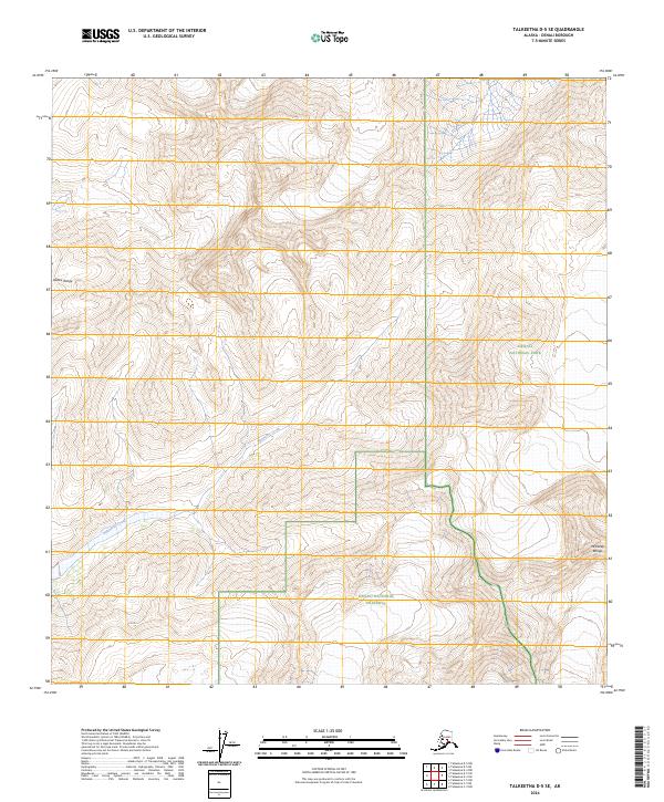
2024 Map of Talkeetna D-5 SE
USGS Topo · Published 2024About this map
Alaska Range peaks and the high-elevation drainages of the McKinley Range dominate this corner of the subarctic interior. The map documents the protected boundary where the Denali National Park meets the Denali National Preserve, a landscape defined more by topography than human infrastructure. The hydrology is characterized by Ripsnorter Creek, which winds through the southern portions of the sheet beneath high ridges and glacial valleys. This survey illustrates the sheer physical scale of the Denali region, showing the exact township lines like t32n r15w and t31n r16w that segment this nearly trackless wilderness.
Find a feature on this map
9 named features on this map. Tap any name to fly to it.
Don’t see what you’re looking for? This feature index may not catch every label — zoom into the map to look around manually.
Map Details
Editions of this 2024 Talkeetna D-5 SE Map
This is the sole edition of this map. No revisions or reprints were ever made.
Other maps of this area

1950 · Talkeetna
USGS Topo · 1:250,000

1951 · Talkeetna
USGS Topo · 1:250,000

1958 · Talkeetna D-5
USGS Topo · 1:63,360

1958 · Talkeetna C-4
USGS Topo · 1:63,360

1958 · Talkeetna D-4
USGS Topo · 1:63,360

1958 · Talkeetna C-5
USGS Topo · 1:63,360

1958 · Talkeetna
USGS Topo · 1:250,000

1965 · Talkeetna
USGS Topo · 1:250,000
2014 · Talkeetna C-4 NW
USGS Topo · 1:25,000
2014 · Talkeetna D-4 NW
USGS Topo · 1:25,000