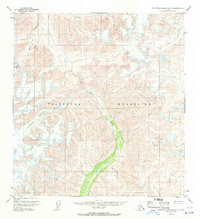
1951 Map of Talkeetna Mountains A-3
USGS Topo · Published 1971About this map
The Talkeetna Mountains dominate this high-altitude landscape as it was documented in 1949 and 1951. The terrain is defined by the massive ice fields of the Talkeetna Glacier and Chickaloon Glacier, which feed the complex drainage systems of the interior. The Talkeetna River and Chickaloon River serve as the primary arterial waterways, carving deep valleys through the mountain range. This survey reveals a wilderness area entirely devoid of roads or trails at the time of mapping, highlighting the remote nature of the Matanuska-Susitna region before modern infrastructure developments. Tributaries like Clear Creek, Caribou Creek, and Glass Creek demonstrate the intricate glacial runoff patterns that shape this portion of the Alaska Range.
Find a feature on this map
8 named features on this map. Tap any name to fly to it.
Don’t see what you’re looking for? This feature index may not catch every label — zoom into the map to look around manually.
Map Details
Editions of this 1951 Talkeetna Mountains A-3 Map
3 editions found
Other maps of this area

1948 · Anchorage D-3
USGS Topo · 1:63,360

1948 · Anchorage D-4
USGS Topo · 1:63,360

1949 · Anchorage D-5
USGS Topo · 1:63,360

1949 · Talkeetna Mountains A-4
USGS Topo · 1:63,360

1950 · Talkeetna Mountains
USGS Topo · 1:250,000

1950 · Talkeetna Mountains B-4
USGS Topo · 1:63,360

1951 · Anchorage
USGS Topo · 1:250,000

1951 · Talkeetna Mountains A-2
USGS Topo · 1:63,360

1951 · Talkeetna Mountains B-3
USGS Topo · 1:63,360

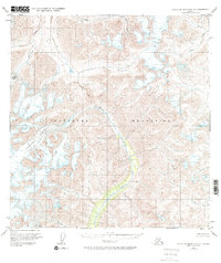
1951 · Talkeetna Mountains A-3
USGS Topo · 1:63,360