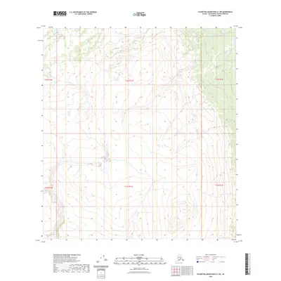
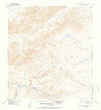
2023 Map of Talkeetna Mountains D-1 SW
USGS Topo · Published 2023About this map
Coal Creek flows through the northwestern reaches of this high-elevation Alaskan landscape, part of a vast watershed within the Matanuska-Susitna region. The topography is dominated by steep mountain slopes and high plateaus, with elevations rising well above 4,000 feet in several areas. The mapping of township lines, including t32n r11e and t31n r11e, provides a precise legal framework for this remote wilderness. This 2023 edition reflects the contemporary state of the Talkeetna Mountains, where the intricate network of drainage basins and ridges remains largely untouched by modern infrastructure. The absence of roads or named settlements underscores the isolated nature of this terrain, making it a critical reference for understanding the natural geography of the Alaska interior.
Find a feature on this map
7 named features on this map. Tap any name to fly to it.
Don’t see what you’re looking for? This feature index may not catch every label — zoom into the map to look around manually.
Map Details
Editions of this 2023 Talkeetna Mountains D-1 SW Map
This is the sole edition of this map. No revisions or reprints were ever made.
Other maps of this area

1950 · Talkeetna Mountains
USGS Topo · 1:250,000

1951 · Talkeetna Mountains C-2
USGS Topo · 1:63,360

1951 · Talkeetna Mountains D-2
USGS Topo · 1:63,360

1951 · Talkeetna Mountains C-1
USGS Topo · 1:63,360

1951 · Talkeetna Mountains D-1
USGS Topo · 1:63,360
1952 · Talkeetna Mountains D-1
USGS Topo · 1:63,360
1952 · Talkeetna Mountains C-1
USGS Topo · 1:63,360
1952 · Talkeetna Mountains C-2
USGS Topo · 1:63,360
1952 · Talkeetna Mountains D-2
USGS Topo · 1:63,360

1954 · Talkeetna Mountains
USGS Topo · 1:250,000