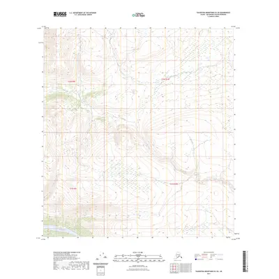
2023 Map of Talkeetna Mountains D-2 SE
USGS Topo · Published 2023About this map
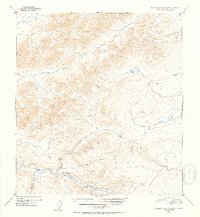
The Susitna River flows through the southern portion of this landscape, marking a significant hydrologic feature in the Talkeetna Mountains. This remote high-elevation terrain is defined by its dramatic relief and glacial drainage patterns, as evidenced by the courses of Jay Creek and Coal Creek. The map provides a detailed view of the township and range system, specifically noting t32n r9e, t32n r10e, t31n r9e, and t31n r10e. Without any roads or settlements printed on the sheet, the geography remains centered on the natural waterways and the precise topography of the Alaskan interior as it was documented in the early 2020s.
Find a feature on this map
7 named features on this map. Tap any name to fly to it.
Don’t see what you’re looking for? This feature index may not catch every label — zoom into the map to look around manually.
Map Details
Editions of this 2023 Talkeetna Mountains D-2 SE Map
This is the sole edition of this map. No revisions or reprints were ever made.
Other maps of this area

1950 · Talkeetna Mountains
USGS Topo · 1:250,000

1951 · Talkeetna Mountains C-2
USGS Topo · 1:63,360

1951 · Talkeetna Mountains D-2
USGS Topo · 1:63,360

1951 · Talkeetna Mountains C-1
USGS Topo · 1:63,360

1951 · Talkeetna Mountains D-1
USGS Topo · 1:63,360
1952 · Talkeetna Mountains D-1
USGS Topo · 1:63,360
1952 · Talkeetna Mountains C-1
USGS Topo · 1:63,360
1952 · Talkeetna Mountains C-2
USGS Topo · 1:63,360
1952 · Talkeetna Mountains D-2
USGS Topo · 1:63,360

1954 · Talkeetna Mountains
USGS Topo · 1:250,000