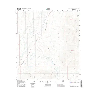
2016 Map of Talkeetna Mountains D-6 NE
USGS Topo · Published 2016About this map
The Parks Highway serves as the primary artery through this high-latitude corridor, following a natural route between the drainage basins of the Chulitna River and the Indian River. This interior Alaskan landscape is defined by its dramatic topographic transitions, anchored by the prominence of Chulitna Butte and the narrow crossing at Chulitna Pass. Near the settlement of Chulitna, the terrain gathers toward Summit Lake, a critical hydrographic feature in this subarctic environment. To the north, the dramatic drop of Hurricane Gulch indicates the scale of the relief, while numerous tributaries like Granite Cr, Division Cr, and Little Coal Creek carve through the surrounding ranges. The map illustrates a balance between modern infrastructure and a wilderness shaped by these watercourses, offering a precise look at the geography north of the Matanuska-Susitna valley.
Find a feature on this map
22 named features on this map. Tap any name to fly to it.
Don’t see what you’re looking for? This feature index may not catch every label — zoom into the map to look around manually.
Map Details
Editions of this 2016 Talkeetna Mountains D-6 NE Map
This is the sole edition of this map. No revisions or reprints were ever made.
Other maps of this area

1949 · Talkeetna Mountains D-6
USGS Topo · 1:63,360

1949 · Healy A-6
USGS Topo · 1:63,360

1950 · Talkeetna Mountains
USGS Topo · 1:250,000

1950 · Talkeetna Mountains D-5
USGS Topo · 1:63,360

1950 · Healy A-5
USGS Topo · 1:63,360

1951 · Healy
USGS Topo · 1:250,000

1951 · Talkeetna Mountains D-5
USGS Topo · 1:63,360

1951 · Talkeetna Mountains D-6
USGS Topo · 1:63,360

1952 · Healy A-5
USGS Topo · 1:63,360

1952 · Talkeetna Mountains D-6
USGS Topo · 1:63,360