
1950 Map of Talkeetna Mountains
USGS Topo · Published 1950About this map
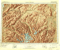
The Alaska Railroad follows the steep corridor of the Susitna River and Chulitna River, serving as the primary lifeline through the western portion of this 1950 reconnaissance survey. Small rail-side settlements such as Hurricane, Sherman, and Canyon mark the route, providing essential points of access into a landscape defined by glacial activity and river drainages. To the east, the Talkeetna Mountains dominate the interior, with notable peaks including Mt Watana 6320 and Lone Butte 3730. The map documents a territory where the transport of resources was paramount, specifically noting Gold deposits near the rail line at Gold Creek. Numerous water bodies such as Fog Lakes and Clarence Lake punctuate the high-elevation flats, while massive ice features like the Eldridge Glacier define the northwestern reaches of the quadrangle near the Chulitna Pass.
Find a feature on this map
97 named features on this map. Tap any name to fly to it.
Don’t see what you’re looking for? This feature index may not catch every label — zoom into the map to look around manually.
Map Details
Editions of this 1950 Talkeetna Mountains Map
2 editions found
Other maps of this area

1948 · Anchorage D-3
USGS Topo · 1:63,360

1948 · Anchorage D-2
USGS Topo · 1:63,360

1948 · Anchorage D-4
USGS Topo · 1:63,360

1948 · Anchorage D-1
USGS Topo · 1:63,360

1949 · Tyonek
USGS Topo · 1:250,000

1949 · Talkeetna Mountains D-6
USGS Topo · 1:63,360

1949 · Anchorage D-5
USGS Topo · 1:63,360

1949 · Anchorage D-7
USGS Topo · 1:63,360

1949 · Talkeetna Mountains B-6
USGS Topo · 1:63,360

1949 · Talkeetna Mountains A-1
USGS Topo · 1:63,360