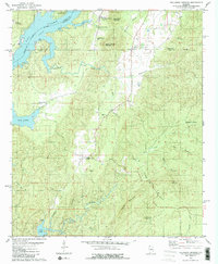
1979 Map of Talladega Springs
USGS Topo · Published 1980About this map
Talladega Springs and the surrounding hillsides at the junction of Talladega, Coosa, and Shelby counties define this 1970s landscape. The area is marked by the sprawling waters of Lay Lake, where Shelby Shores and several boat ramps indicate the recreational development along the Coosa River. Inland, the terrain rises toward Sulphur Spring Mountain and Chalybeate Mountain, reflecting a geography shaped by mineral springs and ridges. Small rural communities like Marble Valley and Strickland Crossroads remain connected by winding creek-side roads. Local genealogy is well-represented through numerous landmarks, including the Union Springs Ch, Sulphur Spring Cem, and the village cemetery at Talladega Springs. The map also captures the industrial footprint of the era, such as a Chert Pit near the lake and the extensive drainage systems of Peckerwood Creek and Paint Creek.
Find a feature on this map
36 named features on this map. Tap any name to fly to it.
Don’t see what you’re looking for? This feature index may not catch every label — zoom into the map to look around manually.
Map Details
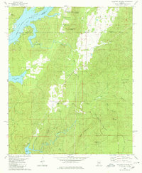
Editions of this 1979 Talladega Springs Map
2 editions found
Other maps of this area

1890 · Bessemer
USGS Topo · 1:125,000

1890 · Talladega
USGS Topo · 1:125,000

1891 · Clanton
USGS Topo · 1:125,000

1892 · Talladega
USGS Topo · 1:125,000

1892 · Bessemer
USGS Topo · 1:125,000

1901 · Wetumpka
USGS Topo · 1:125,000

1903 · Wetumpka
USGS Topo · 1:125,000

1909 · Columbiana
USGS Topo · 1:62,500

1911 · Columbiana
USGS Topo · 1:62,500

1915 · Gantts Quarry
USGS Topo · 1:48,000
Featured Places
- Talladega Springs, AL
- Strickland Crossroads, AL
- Blue Springs, AL
- Marble Valley, AL
- Sulphur Spring, Talladega Springs