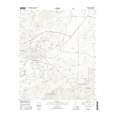
2014 Map of Talladega
USGS Topo · Published 2014About this map
The city of Talladega serves as the focal point of this survey, surrounded by established neighborhoods and industrial heritage. The campus of Talladega Coll and the historically significant Nances Hill church mark the urban landscape, while the southern reaches descend into the Talladega National Forest. In this section of the county, the landscape is defined by the transition from the city center to the smaller outlying communities of Bemiston, Jonesville, and Pulliamville.
Find a feature on this map
190 named features on this map. Tap any name to fly to it.
Don’t see what you’re looking for? This feature index may not catch every label — zoom into the map to look around manually.
Map Details
Editions of this 2014 Talladega Map
This is the sole edition of this map. No revisions or reprints were ever made.
Other maps of this area

1889 · Springville
USGS Topo · 1:125,000

1890 · Talladega
USGS Topo · 1:125,000

1891 · Ashland
USGS Topo · 1:125,000

1892 · Springville
USGS Topo · 1:125,000

1892 · Talladega
USGS Topo · 1:125,000

1900 · Anniston
USGS Topo · 1:125,000

1943 · Talladega
USGS Topo · 1:62,500

1946 · Talladega
USGS Topo · 1:62,500

1947 · Eastaboga
USGS Topo · 1:24,000

1947 · Ragland
USGS Topo · 1:62,500