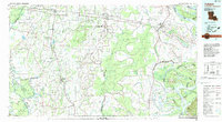
1982 Map of Tallulah
USGS Topo · Published 1983About this map
The alluvial floodplains of the Mississippi River define this 1982 map of Northeast Louisiana, showcasing a landscape deeply carved by river dynamics and agricultural development. The serpentine path of the river creates complex oxbows and landforms like Yucatan Lake, Palmyra Chute, and Diamond Point, while the interior is a dense network of bayous including Joes Bayou and Macon Bayou. Major transportation corridors are established by the Illinois Central Gulf and Missouri Pacific railroads, which connect key parish seats and trade centers.
Find a feature on this map
93 named features on this map. Tap any name to fly to it.
Don’t see what you’re looking for? This feature index may not catch every label — zoom into the map to look around manually.
Map Details
Editions of this 1982 Tallulah Map
This is the sole edition of this map. No revisions or reprints were ever made.
Other maps of this area

1909 · Delta Bridge
USGS Topo · 1:24,000

1909 · Lake Bruen
USGS Topo · 1:24,000

1909 · Millikens Bend
USGS Topo · 1:24,000

1909 · Tallulah
USGS Topo · 1:24,000

1909 · Mound
USGS Topo · 1:24,000

1910 · Mound
USGS Topo · 1:31,680

1918 · Vicksburg
USGS Topo · 1:62,500

1935 · Collinston
USGS Topo · 1:62,500

1935 · Winnsboro
USGS Topo · 1:62,500

1935 · Alto
USGS Topo · 1:62,500