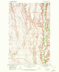
1969 Map of Tampico NE
USGS Topo · Published 1972About this map
The Lewis and Clark Trail traverses the southern edge of this landscape, marking a path of immense historical significance through the drainage basins of north-central Montana. The terrain is defined by a dense network of erosional features, most notably the deeply etched Black Coulee and Unger Coulee, which flow toward the more prominent Buggy Creek in the east. This 1969 field-checked survey reveals the logistical footprint of the Missouri River Basin development program, seen in scattered infrastructure such as Reservoir No 1 and a Gravel Pit near the trail route.
Find a feature on this map
11 named features on this map. Tap any name to fly to it.
Don’t see what you’re looking for? This feature index may not catch every label — zoom into the map to look around manually.
Map Details
Editions of this 1969 Tampico NE Map
This is the sole edition of this map. No revisions or reprints were ever made.
Other maps of this area

1919 · Boundary
USGS Topo · 1:125,000

1943 · Glasgow
USGS Topo · 1:125,000

1954 · Glasgow
USGS Topo · 1:250,000

1957 · Glasgow
USGS Topo · 1:250,000

1958 · Glasgow
USGS Topo · 1:250,000

1969 · Cornwell Reservoir
USGS Topo · 1:24,000
1969 · Tampico
USGS Topo · 1:24,000
1969 · Chapman Coulee
USGS Topo · 1:24,000

1969 · Vandalia
USGS Topo · 1:24,000

1969 · Ellsworth Coulee
USGS Topo · 1:24,000