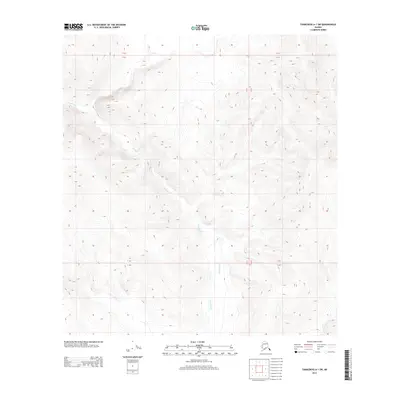
2013 Map of Tanacross A-1 SW
USGS Topo · Published 2013About this map
Gardiner Creek is the defining geographical feature of this interior Alaska wilderness, carving a winding path through the high-elevation terrain within the Township 16 North and 15 North boundary. This 2013 survey documents a remote landscape where drainage patterns are dictated by the steep contours of the Unorganized Borough. The absence of roads or established settlements emphasizes the pristine nature of this region, where Gardiner Creek serves as the primary hydrological artery. Topographic detail reveals the complex system of ridges and valleys that characterize this portion of the Tanacross region, providing a record of the area's natural state before any human infrastructure reached these specific coordinates.
Find a feature on this map
4 named features on this map. Tap any name to fly to it.
Don’t see what you’re looking for? This feature index may not catch every label — zoom into the map to look around manually.
Map Details
Editions of this 2013 Tanacross A-1 SW Map
This is the sole edition of this map. No revisions or reprints were ever made.
Other maps of this area

1949 · Tanacross
USGS Topo · 1:250,000

1950 · Tanacross
USGS Topo · 1:250,000

1950 · Nabesna
USGS Topo · 1:250,000

1951 · Nabesna
USGS Topo · 1:250,000

1952 · Nabesna D-1
USGS Topo · 1:63,360

1952 · Tanacross A-1
USGS Topo · 1:63,360

1954 · Tanacross A-2
USGS Topo · 1:63,360

1954 · Nabesna D-2
USGS Topo · 1:63,360

1955 · Tanacross A-2
USGS Topo · 1:63,360

1955 · Nabesna D-2
USGS Topo · 1:63,360