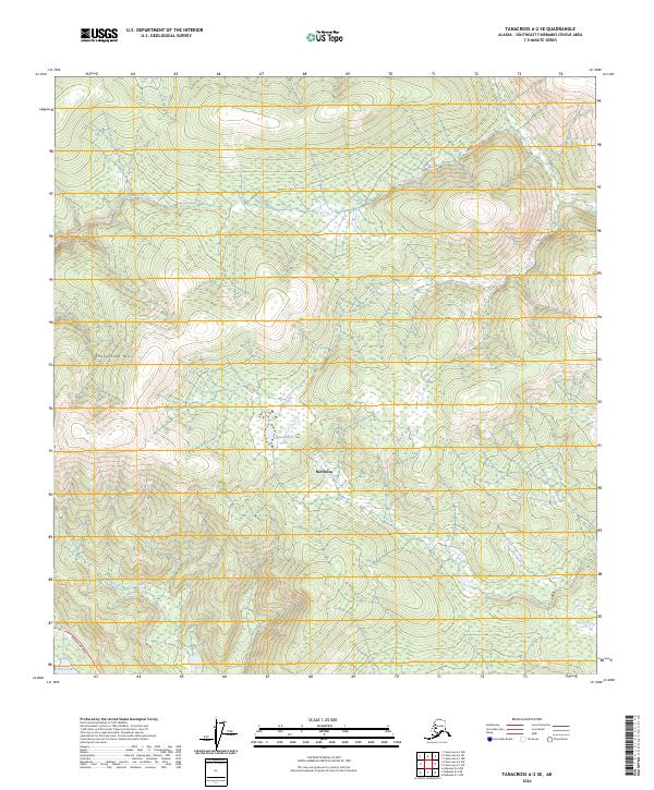
2024 Map of Tanacross A-2 SE
USGS Topo · Published 2024About this map
Northway serves as a focal point in this portion of the Alaska interior, where the Alaska Highway cuts across the southwestern corner of the terrain. The landscape is defined by the wetlands and complex hydrology of the Tetlin National Wildlife Refuge, featuring several prominent water bodies including Damundtali Lake and Curve Lake. This area demonstrates the importance of glacial and river-fed systems, with Beaver Creek and Gardiner Creek meandering through the northeast and Silver Creek flowing to the south.
Find a feature on this map
18 named features on this map. Tap any name to fly to it.
Don’t see what you’re looking for? This feature index may not catch every label — zoom into the map to look around manually.
Map Details
Editions of this 2024 Tanacross A-2 SE Map
This is the sole edition of this map. No revisions or reprints were ever made.
Other maps of this area

1949 · Tanacross
USGS Topo · 1:250,000

1950 · Tanacross
USGS Topo · 1:250,000

1950 · Nabesna
USGS Topo · 1:250,000

1951 · Nabesna
USGS Topo · 1:250,000

1952 · Nabesna D-1
USGS Topo · 1:63,360

1952 · Tanacross A-1
USGS Topo · 1:63,360

1954 · Tanacross A-2
USGS Topo · 1:63,360

1954 · Nabesna D-2
USGS Topo · 1:63,360

1955 · Tanacross A-2
USGS Topo · 1:63,360

1955 · Nabesna D-2
USGS Topo · 1:63,360