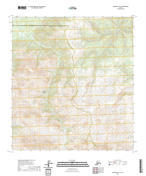
2024 Map of Tanacross A-5 SE
USGS Topo · Published 2024About this map
Mentasta Lake sits near the heart of this high-elevation Alaskan terrain, where the boundary between the Southeast Fairbanks Census Area and the Copper River Census Area carves through the landscape. This 2024 survey captures the hydrological patterns of the region, specifically where Log Cabin Creek and Trail Creek navigate the steep gradients of the surrounding mountains. The map provides a contemporary look at the Public Land Survey System grid, including townships like t15n r12e, superimposed over a wilderness defined by significant relief and glacial-fed drainage systems. The relative isolation of the water bodies shown here underscores the remote nature of the eastern Alaska interior, serving as an essential record of modern boundary and topographical data.
Find a feature on this map
14 named features on this map. Tap any name to fly to it.
Don’t see what you’re looking for? This feature index may not catch every label — zoom into the map to look around manually.
Map Details
Editions of this 2024 Tanacross A-5 SE Map
This is the sole edition of this map. No revisions or reprints were ever made.
Other maps of this area

1948 · Tanacross A-4
USGS Topo · 1:63,360

1948 · Nabesna D-5
USGS Topo · 1:63,360

1948 · Tanacross A-5
USGS Topo · 1:63,360

1949 · Tanacross
USGS Topo · 1:250,000

1949 · Tanacross A-5
USGS Topo · 1:63,360

1950 · Tanacross
USGS Topo · 1:250,000

1950 · Nabesna
USGS Topo · 1:250,000

1950 · Nabesna D-5
USGS Topo · 1:63,360

1951 · Nabesna
USGS Topo · 1:250,000

1952 · Tanacross A-4
USGS Topo · 1:63,360