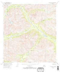
1948 Map of Tanacross A-6
USGS Topo · Published 1965About this map
The Tok River drainage system dominates this interior Alaskan landscape, as mapped from aerial photography in the late 1940s. Flowing through steep valleys and across wide gravel bars, the river is joined by numerous tributaries including Stibnite Creek, Shindata Creek, and Natohona Creek. This unpopulated wilderness shows only one small Cabin along the river's path, indicating the extreme isolation of the territory at the time of the survey. The terrain transitions from river bottoms toward the high summits of VABM White 7302 and the critical high-altitude route at Sikonsina Pass. In the southern reaches of the quadrangle, the landscape shifts toward the heads of Bone Creek and Station Creek, while Burnt Lake and its namesake Burnt Creek sit tucked between the ridges. This map captures a moment before modern road infrastructure, preserving the original hydrography and topography of the eastern Alaska Range.
Find a feature on this map
14 named features on this map. Tap any name to fly to it.
Don’t see what you’re looking for? This feature index may not catch every label — zoom into the map to look around manually.
Map Details
Editions of this 1948 Tanacross A-6 Map
2 editions found
Other maps of this area

1948 · Tanacross B-5
USGS Topo · 1:63,360

1948 · Tanacross A-6
USGS Topo · 1:63,360

1948 · Nabesna D-5
USGS Topo · 1:63,360

1948 · Tanacross A-5
USGS Topo · 1:63,360

1949 · Tanacross
USGS Topo · 1:250,000

1949 · Nabesna D-6
USGS Topo · 1:63,360

1949 · Tanacross A-5
USGS Topo · 1:63,360

1949 · Tanacross B-6
USGS Topo · 1:63,360

1949 · Mt. Hayes A-1
USGS Topo · 1:63,360

1950 · Tanacross
USGS Topo · 1:250,000