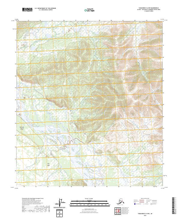
2024 Map of Tanacross C-6 NW
USGS Topo · Published 2024About this map
Tanana River dominates this interior landscape, weaving a complex network of braided channels and wetlands across the terrain. Along its northern banks, the settlements of Dot Lake Village and Dot Lake represent the primary points of human habitation in this part of the Southeast Fairbanks Census Area. The topography is defined by the significant elevation changes between the river valley and the rising slopes to the north and south, where numerous small waterways like Chief Creek, Bear Creek, and Billy Creek drain into the glacial waters of the Tanana. This 2024 U.S. Geological Survey record indicates a landscape where water and wetlands dictate the patterns of access and settlement, with the Tanana serving as the central geographic anchor for the region's indigenous and local communities.
Find a feature on this map
14 named features on this map. Tap any name to fly to it.
Don’t see what you’re looking for? This feature index may not catch every label — zoom into the map to look around manually.
Map Details
Editions of this 2024 Tanacross C-6 NW Map
This is the sole edition of this map. No revisions or reprints were ever made.
Other maps of this area

1949 · Tanacross
USGS Topo · 1:250,000

1950 · Tanacross
USGS Topo · 1:250,000

1950 · Mount Hayes
USGS Topo · 1:250,000

1951 · Mount Hayes
USGS Topo · 1:250,000

1954 · Tanacross C-6
USGS Topo · 1:63,360

1954 · Mount Hayes D-1
USGS Topo · 1:63,360

1954 · Tanacross D-6
USGS Topo · 1:63,360

1954 · Mount Hayes C-1
USGS Topo · 1:63,360

1955 · Mount Hayes C-1
USGS Topo · 1:63,360
1955 · Tanacross C-6
USGS Topo · 1:63,360