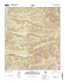
2013 Map of Tanacross D-2 NW
USGS Topo · Published 2013About this map
Dennison Fork snakes through this portion of the Southeast Fairbanks interior, winding past the western boundary of Township 25 North. The terrain is characterized by a series of high ridges and narrow drainage basins typical of this region of Alaska, with Atwater Cr draining the northeastern corner of the sheet. The absence of roads or established settlements on this 2013 survey emphasizes the persistent wilderness character of the landscape. Researchers can use the precise Public Land Survey System grids, such as the intersection of Range 18 East and Range 19 East, to pinpoint specific geographical coordinates in this remote river-fork country.
Find a feature on this map
6 named features on this map. Tap any name to fly to it.
Don’t see what you’re looking for? This feature index may not catch every label — zoom into the map to look around manually.
Map Details
Editions of this 2013 Tanacross D-2 NW Map
This is the sole edition of this map. No revisions or reprints were ever made.
Other maps of this area

1899 · Fortymile
USGS Topo · 1:250,000

1949 · Tanacross
USGS Topo · 1:250,000

1950 · Tanacross
USGS Topo · 1:250,000

1951 · Eagle
USGS Topo · 1:250,000

1956 · Tanacross D-3
USGS Topo · 1:63,360

1956 · Tanacross D-2
USGS Topo · 1:63,360

1956 · Eagle A-2
USGS Topo · 1:63,360

1956 · Tanacross
USGS Topo · 1:250,000
1957 · Eagle A-3
USGS Topo · 1:63,360

1957 · Eagle
USGS Topo · 1:250,000