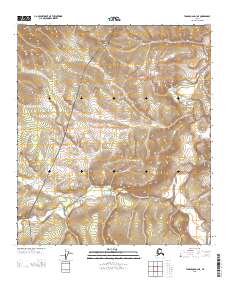
2013 Map of Tanacross D-3 NE
USGS Topo · Published 2013About this map
The Taylor Hwy cuts a striking diagonal through this interior Alaska landscape, following the ridgeline between deep river drainage systems. This 2013 survey illustrates the rugged watershed of the Dennison Fork, where the terrain drops sharply from the highway's high ground into the winding valley of the W Fork Dennison Fork. The map detail captures the characteristic isolation of the Southeast Fairbanks region, defined by the relationship between the singular road corridor and the natural flow of Taylor Cr. The contour density reveals the dramatic elevation changes that govern travel and drainage in this subarctic environment, offering a clear view of the land's shape before the summer thaw or winter freeze.
Find a feature on this map
8 named features on this map. Tap any name to fly to it.
Don’t see what you’re looking for? This feature index may not catch every label — zoom into the map to look around manually.
Map Details
Editions of this 2013 Tanacross D-3 NE Map
This is the sole edition of this map. No revisions or reprints were ever made.
Other maps of this area

1899 · Fortymile
USGS Topo · 1:250,000

1949 · Tanacross
USGS Topo · 1:250,000

1950 · Tanacross
USGS Topo · 1:250,000

1951 · Eagle
USGS Topo · 1:250,000

1956 · Tanacross D-3
USGS Topo · 1:63,360

1956 · Tanacross D-2
USGS Topo · 1:63,360

1956 · Eagle A-2
USGS Topo · 1:63,360

1956 · Tanacross
USGS Topo · 1:250,000
1957 · Eagle A-3
USGS Topo · 1:63,360

1957 · Eagle
USGS Topo · 1:250,000