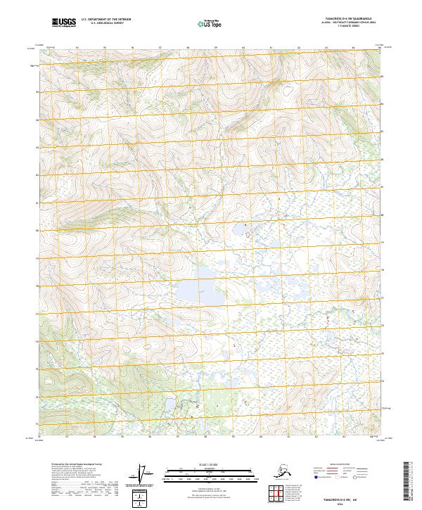
2024 Map of Tanacross D-6 SW
USGS Topo · Published 2024About this map
T Lake and the meandering course of Billy Creek define the interior of this Tanacross region within the Southeast Fairbanks Census Area. The landscape is characterized by extensive wetland systems and undulating contours that dictate the natural drainage patterns across the survey. While human-constructed landmarks are absent from this particular sheet, the intricate hydrography revealed in the Billy Creek drainage suggests the remote and undisturbed character of this Alaskan interior. The mapping of T Lake provides a clear focal point for understanding the local topography and the subtle transitions between forested uplands and saturated lowlands in this section of the subarctic wilderness.
Find a feature on this map
7 named features on this map. Tap any name to fly to it.
Don’t see what you’re looking for? This feature index may not catch every label — zoom into the map to look around manually.
Map Details
Editions of this 2024 Tanacross D-6 SW Map
This is the sole edition of this map. No revisions or reprints were ever made.
Other maps of this area

1949 · Tanacross
USGS Topo · 1:250,000

1950 · Tanacross
USGS Topo · 1:250,000

1950 · Mount Hayes
USGS Topo · 1:250,000

1951 · Mount Hayes
USGS Topo · 1:250,000

1954 · Tanacross C-6
USGS Topo · 1:63,360

1954 · Mount Hayes D-1
USGS Topo · 1:63,360

1954 · Tanacross D-6
USGS Topo · 1:63,360

1954 · Mount Hayes C-1
USGS Topo · 1:63,360

1955 · Mount Hayes C-1
USGS Topo · 1:63,360
1955 · Tanacross C-6
USGS Topo · 1:63,360