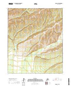
2017 Map of Tanana A-1 NE
USGS Topo · Published 2017About this map
The settlement of Eureka serves as the focal point for this interior Alaskan landscape, positioned where high-altitude ridge lines descend toward the drainage basins of Pioneer Cr and Eureka Cr. The presence of the Eureka Creek Airport and the Elliott Highway indicates the critical transportation infrastructure necessary for life and industry in the Yukon-Koyukuk region. To the north, the terrain rises significantly toward Eureka Dome, a prominent landmark overlooking a network of gold-bearing stream names like Minook Cr and Boston Cr. The geography is defined by a dendritic drainage pattern where numerous creeks, including Hutlinana Cr and Silverbow Cr, carve through the uplands. This area historically represents a hub of placer mining activity, with various gulches and creeks serving as identifiers for claims and early twentieth-century prospecting routes through the Alaskan interior.
Find a feature on this map
30 named features on this map. Tap any name to fly to it.
Don’t see what you’re looking for? This feature index may not catch every label — zoom into the map to look around manually.
Map Details
Editions of this 2017 Tanana A-1 NE Map
This is the sole edition of this map. No revisions or reprints were ever made.
Other maps of this area

1945 · Livengood
USGS Topo · 1:250,000

1951 · Tanana
USGS Topo · 1:250,000

1951 · Livengood
USGS Topo · 1:250,000

1952 · Tanana A-1
USGS Topo · 1:63,360

1952 · Livengood A-6
USGS Topo · 1:63,360

1953 · Livengood A-6
USGS Topo · 1:63,360

1956 · Tanana B-1
USGS Topo · 1:63,360

1956 · Livengood B-6
USGS Topo · 1:63,360

1956 · Livengood
USGS Topo · 1:250,000

1956 · Tanana
USGS Topo · 1:250,000