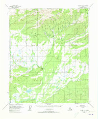
1952 Map of Tanana A-1
USGS Topo · Published 1973About this map
Eureka sits at the heart of this interior Alaskan landscape, serving as a focal point for the region's early-to-mid-20th-century mining and transportation activity. The terrain is defined by a complex network of man-made waterways like Thanksgiving Ditch, Pioneer Ditch, and Glenn Ditch, which were critical for hydraulic mining operations. Evidence of these industrial efforts is visible near Glen, where Tailings are noted along the drainage. The map reveals a transition from the higher elevations of Eureka Dome and Overland Bluff down to the watery lowlands of Baker Lake and Baker Slough. A rudimentary transportation network connects these sites, including a Tractor Trail and a remote Landing Strip, illustrating how people navigated the wilderness before modern road infrastructure. To the south, the landscape softens into the Dugan Hills and the meandering path of Hot Springs Creek.
Find a feature on this map
51 named features on this map. Tap any name to fly to it.
Don’t see what you’re looking for? This feature index may not catch every label — zoom into the map to look around manually.
Map Details
Editions of this 1952 Tanana A-1 Map
3 editions found
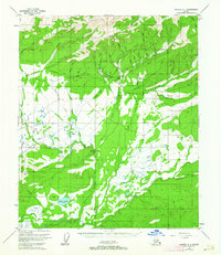
Other maps of this area

1945 · Livengood
USGS Topo · 1:250,000

1948 · Kantishna River
USGS Topo · 1:250,000

1950 · Fairbanks
USGS Topo · 1:250,000

1951 · Kantishna River
USGS Topo · 1:250,000

1951 · Fairbanks
USGS Topo · 1:250,000

1951 · Tanana
USGS Topo · 1:250,000

1951 · Livengood
USGS Topo · 1:250,000

1952 · Tanana A-1
USGS Topo · 1:63,360

1952 · Livengood A-6
USGS Topo · 1:63,360

1952 · Tanana A-2
USGS Topo · 1:63,360