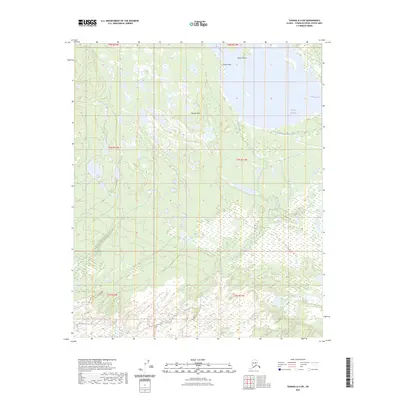
2023 Map of Tanana A-4 SW
USGS Topo · Published 2023About this map
The Tanana River dominates the northern landscape of this region in the Yukon-Koyukuk Census Area, serving as a primary hydrologic artery. Nearby, the Aeolian Hills rise above the surrounding wetlands, featuring the distinctively named Aeolian Crossing. This 2023 survey by the U.S. Geological Survey illustrates a complex network of interior waterways and drainage patterns, including the winding course of Birch Creek and the quiet waters of Green Slough. The presence of Station Rocks and the singular Station Rock provides fixed navigational points along the river's path, highlighting the transition between the moving water and the stable geological formations of the Alaskan interior.
Find a feature on this map
13 named features on this map. Tap any name to fly to it.
Don’t see what you’re looking for? This feature index may not catch every label — zoom into the map to look around manually.
Map Details
Editions of this 2023 Tanana A-4 SW Map
This is the sole edition of this map. No revisions or reprints were ever made.
Other maps of this area

1948 · Kantishna River
USGS Topo · 1:250,000

1951 · Kantishna River
USGS Topo · 1:250,000

1951 · Tanana
USGS Topo · 1:250,000

1952 · Tanana A-4
USGS Topo · 1:63,360

1952 · Kantishna River D-5
USGS Topo · 1:63,360

1952 · Kantishna River
USGS Topo · 1:250,000

1952 · Tanana A-5
USGS Topo · 1:63,360
1953 · Kantishna River D-5
USGS Topo · 1:63,360

1953 · Tanana A-5
USGS Topo · 1:63,360
1953 · Kantishna River D-4
USGS Topo · 1:63,360