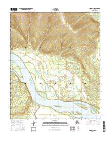
2016 Map of Tanana A-6 NE
USGS Topo · Published 2016About this map
The Yukon River dominates this interior Alaskan landscape, carving a wide path through the Tanana region as it moves past a series of named landforms and seasonal waterways. High ground is anchored by Gold Hill in the north, which overlooks a complex network of side channels and islands. These braided river features include Swanson Island and Little Joker Island, which are separated from the main banks by Swanson Slough and Whiskey Jack Slough. To the south, the Atutsak River flows into the main channel near Basco Island. Small tributaries like Gold Hill Cr and Ravine Cr drain the northern uplands, illustrating the hydrological connection between the ridge systems and the great river basin. This survey provides a precise view of the river's geometry and island positions before further natural shifts in the shoreline occur.
Find a feature on this map
16 named features on this map. Tap any name to fly to it.
Don’t see what you’re looking for? This feature index may not catch every label — zoom into the map to look around manually.
Map Details
Editions of this 2016 Tanana A-6 NE Map
This is the sole edition of this map. No revisions or reprints were ever made.
Other maps of this area

1951 · Tanana
USGS Topo · 1:250,000

1952 · Tanana A-6
USGS Topo · 1:63,360

1952 · Tanana A-5
USGS Topo · 1:63,360

1953 · Tanana A-5
USGS Topo · 1:63,360

1956 · Tanana B-5
USGS Topo · 1:63,360

1956 · Tanana B-6
USGS Topo · 1:63,360

1956 · Tanana
USGS Topo · 1:250,000

1960 · Tanana
USGS Topo · 1:250,000
2016 · Tanana B-6 SW
USGS Topo · 1:25,000
2016 · Tanana B-5 SW
USGS Topo · 1:25,000