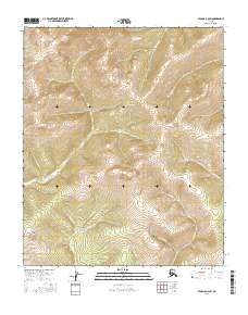
2016 Map of Tanana B-6 SW
USGS Topo · Published 2016About this map
Grant Dome and Lynx Dome anchor the high ground of this interior Alaska wilderness, defining a landscape of complex drainages within the Tanana B-6 SW quadrangle. The terrain is deeply inscribed by a network of creeks including Golden Cr, Tazimoran Cr, and Grant Cr, which radiate from the central uplands. The nomenclature of these waterways—such as Thirteen Pup, Gay Cr, and Frankie Cr—hints at the era of early prospecting and localized mining claims that often followed these remote tributary systems. This 2016 survey by the U.S. Geological Survey provides a precise record of the natural topography, showing the intricate relationship between the elevated domes and the various colored and named streams like Yellow Cr and Bluebell Cr that carve through the surrounding valleys.
Find a feature on this map
18 named features on this map. Tap any name to fly to it.
Don’t see what you’re looking for? This feature index may not catch every label — zoom into the map to look around manually.
Map Details
Editions of this 2016 Tanana B-6 SW Map
This is the sole edition of this map. No revisions or reprints were ever made.
Other maps of this area

1951 · Melozitna
USGS Topo · 1:250,000

1951 · Tanana
USGS Topo · 1:250,000

1952 · Tanana A-6
USGS Topo · 1:63,360

1952 · Melozitna A-1
USGS Topo · 1:63,360

1956 · Melozitna B-1
USGS Topo · 1:63,360

1956 · Tanana B-6
USGS Topo · 1:63,360

1956 · Melozitna
USGS Topo · 1:250,000

1956 · Tanana
USGS Topo · 1:250,000

1960 · Tanana
USGS Topo · 1:250,000
2016 · Tanana B-6 NW
USGS Topo · 1:25,000