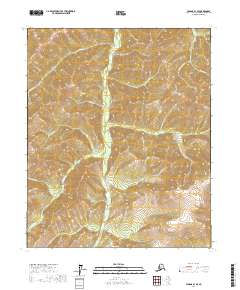
2017 Map of Tanana B-1 SE
USGS Topo · Published 2017About this map
Minook Cr flows northward through this Interior Alaska landscape, serving as the central drainage for a series of high-elevation tributaries. The terrain is defined by dramatic ridgelines and several prominent peaks, most notably Elephant Mtn in the southeast. This 2017 survey details a network of creeks that have long defined the local geography, including Ninetytwo Pup, Slate Cr, and Hoosier Cr.
Find a feature on this map
18 named features on this map. Tap any name to fly to it.
Don’t see what you’re looking for? This feature index may not catch every label — zoom into the map to look around manually.
Map Details
Editions of this 2017 Tanana B-1 SE Map
This is the sole edition of this map. No revisions or reprints were ever made.
Other maps of this area

1945 · Livengood
USGS Topo · 1:250,000

1951 · Tanana
USGS Topo · 1:250,000

1951 · Livengood
USGS Topo · 1:250,000

1952 · Tanana A-1
USGS Topo · 1:63,360

1952 · Livengood A-6
USGS Topo · 1:63,360

1953 · Livengood A-6
USGS Topo · 1:63,360

1956 · Tanana B-1
USGS Topo · 1:63,360

1956 · Livengood B-6
USGS Topo · 1:63,360

1956 · Livengood
USGS Topo · 1:250,000

1956 · Tanana
USGS Topo · 1:250,000