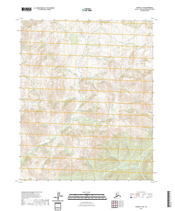
2023 Map of Tanana C-2 NE
USGS Topo · Published 2023About this map
Tozitna River winds through the interior landscape of the Yukon-Koyukuk Census Area, serving as the primary drainage for the surrounding uplands. This 2023 survey provides a clear look at the intricate topography of the region, where the river's path is defined by a series of steep drainages and ridge lines. The elevation data reveals the complex hydrology of the area, including the smaller Lush Creek which joins the broader system in the southeastern quadrant. The map detail highlights the Public Land Survey System grids, including t11n r15w and t10n r14w, illustrating how the wilderness is partitioned for administrative and survey purposes. In an area largely devoid of roads or permanent structures, the natural watercourses remain the dominant landmarks for navigation and land study.
Find a feature on this map
8 named features on this map. Tap any name to fly to it.
Don’t see what you’re looking for? This feature index may not catch every label — zoom into the map to look around manually.
Map Details
Editions of this 2023 Tanana C-2 NE Map
This is the sole edition of this map. No revisions or reprints were ever made.
Other maps of this area

1951 · Tanana
USGS Topo · 1:250,000

1956 · Tanana C-1
USGS Topo · 1:63,360

1956 · Tanana D-2
USGS Topo · 1:63,360

1956 · Tanana C-2
USGS Topo · 1:63,360

1956 · Tanana D-1
USGS Topo · 1:63,360

1956 · Tanana
USGS Topo · 1:250,000

1960 · Tanana
USGS Topo · 1:250,000
2017 · Tanana C-1 SW
USGS Topo · 1:25,000
2017 · Tanana D-2 SW
USGS Topo · 1:25,000
2017 · Tanana C-2 SE
USGS Topo · 1:25,000