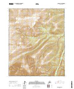
2017 Map of Tanana D-2 SW
USGS Topo · Published 2017About this map
Big Salt River winds through the southeastern corner of this interior Alaskan landscape, which remains largely defined by its natural drainage patterns and high-latitude topography. This 2017 survey shows a region centered on the upland drainage of Halu Cr, where the stream system carves through the interior before feeding into larger river basins. The map illustrates the Public Land Survey System divisions for several townships, including t12n r16w and t11n r16w, providing a precise grid over a wilderness area where human-made infrastructure is notably absent. For researchers and geographers, the map offers a clear look at the elevation contours and hydrological network of the Yukon-Koyukuk Census Area, recording the terrain as it existed in the early 21st century.
Find a feature on this map
7 named features on this map. Tap any name to fly to it.
Don’t see what you’re looking for? This feature index may not catch every label — zoom into the map to look around manually.
Map Details
Editions of this 2017 Tanana D-2 SW Map
This is the sole edition of this map. No revisions or reprints were ever made.
Other maps of this area

1951 · Tanana
USGS Topo · 1:250,000

1956 · Tanana D-2
USGS Topo · 1:63,360

1956 · Tanana D-3
USGS Topo · 1:63,360

1956 · Tanana C-3
USGS Topo · 1:63,360

1956 · Tanana C-2
USGS Topo · 1:63,360

1956 · Tanana
USGS Topo · 1:250,000

1960 · Tanana
USGS Topo · 1:250,000
2016 · Tanana D-3 SE
USGS Topo · 1:25,000
2016 · Tanana D-3 NE
USGS Topo · 1:25,000
2016 · Tanana C-3 NE
USGS Topo · 1:25,000