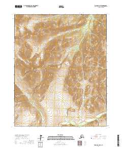
2017 Map of Tanana C-2 NW
USGS Topo · Published 2017About this map
Ray Mountains dominate the interior landscape of this region, which remains primarily defined by its drainage systems and high-altitude terrain. The presence of Mt Tozi provides a significant landmark for orientation within the central portion of the survey area. Hydrologically, the map is shaped by the headwaters and tributaries of several prominent waterways. The northern reaches are drained by the Big Salt River, while the southern sections are characterized by the Tozitna River. Smaller drainages such as Crash Cr and Twilight Cr provide a closer look at how water moves through this part of the Yukon-Koyukuk Census Area. This survey serves as a record of an undeveloped wilderness where topography is the primary feature, lacking the roads or settlements found in more inhabited Alaskan regions.
Find a feature on this map
15 named features on this map. Tap any name to fly to it.
Don’t see what you’re looking for? This feature index may not catch every label — zoom into the map to look around manually.
Map Details
Editions of this 2017 Tanana C-2 NW Map
This is the sole edition of this map. No revisions or reprints were ever made.
Other maps of this area

1951 · Tanana
USGS Topo · 1:250,000

1956 · Tanana D-2
USGS Topo · 1:63,360

1956 · Tanana D-3
USGS Topo · 1:63,360

1956 · Tanana C-3
USGS Topo · 1:63,360

1956 · Tanana C-2
USGS Topo · 1:63,360

1956 · Tanana
USGS Topo · 1:250,000

1960 · Tanana
USGS Topo · 1:250,000
2016 · Tanana D-3 SE
USGS Topo · 1:25,000
2016 · Tanana C-3 NE
USGS Topo · 1:25,000
2016 · Tanana C-3 SE
USGS Topo · 1:25,000