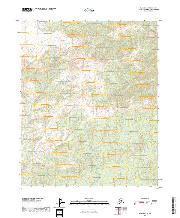
2023 Map of Tanana C-2 SE
USGS Topo · Published 2023About this map
Moose Creek and Roadhouse Creek define the drainage patterns of this interior Alaskan wilderness within the Yukon-Koyukuk Census Area. The terrain is characterized by a series of high ridges and deep valleys, clearly delineated by the Public Land Survey System grids of t9n r15w, t9n r14w, and t8n r15w. This 2023 survey indicates an area devoid of modern infrastructure or established settlements, showing the landscape in its natural state. The absence of roads or structures in this specific quadrangle suggests a remote territory primarily utilized for resource management or traditional passage, with the creek names hinting at historical travel routes or early twentieth-century bush travel history common to the Tanana region.
Find a feature on this map
7 named features on this map. Tap any name to fly to it.
Don’t see what you’re looking for? This feature index may not catch every label — zoom into the map to look around manually.
Map Details
Editions of this 2023 Tanana C-2 SE Map
This is the sole edition of this map. No revisions or reprints were ever made.
Other maps of this area

1951 · Tanana
USGS Topo · 1:250,000

1956 · Tanana B-1
USGS Topo · 1:63,360

1956 · Tanana C-1
USGS Topo · 1:63,360

1956 · Tanana B-2
USGS Topo · 1:63,360

1956 · Tanana C-2
USGS Topo · 1:63,360

1956 · Tanana
USGS Topo · 1:250,000

1960 · Tanana
USGS Topo · 1:250,000
2017 · Tanana B-1 NW
USGS Topo · 1:25,000
2017 · Tanana C-1 SW
USGS Topo · 1:25,000
2017 · Tanana B-2 NW
USGS Topo · 1:25,000