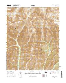
2016 Map of Tanana C-3 NW
USGS Topo · Published 2016About this map
Spooky Valley lies within this high-latitude terrain of the Yukon-Koyukuk region, where the drainage systems of the interior dictate the shape of the land. The Kanuti Kilolitna River enters from the northwest, while several significant tributaries including Fleshlanana Creek and Kobuk Creek carve through the elevation. This 2016 survey by the U.S. Geological Survey illustrates a wilderness defined by its complex hydrology and vertical relief rather than human infrastructure. The presence of Gishia Creek at the southern boundary highlights the intricate network of alpine streams that feed the larger river basins of central Alaska. There are no marked roads or settlements on this sheet, indicating an area largely preserved in its natural state, valuable for those studying modern geomorphology and untouched hydrological patterns.
Find a feature on this map
11 named features on this map. Tap any name to fly to it.
Don’t see what you’re looking for? This feature index may not catch every label — zoom into the map to look around manually.
Map Details
Editions of this 2016 Tanana C-3 NW Map
This is the sole edition of this map. No revisions or reprints were ever made.
Other maps of this area

1951 · Tanana
USGS Topo · 1:250,000

1956 · Tanana D-4
USGS Topo · 1:63,360

1956 · Tanana D-3
USGS Topo · 1:63,360

1956 · Tanana C-3
USGS Topo · 1:63,360

1956 · Tanana C-4
USGS Topo · 1:63,360

1956 · Tanana
USGS Topo · 1:250,000

1960 · Tanana
USGS Topo · 1:250,000
2016 · Tanana D-4 SE
USGS Topo · 1:25,000
2016 · Tanana D-3 SE
USGS Topo · 1:25,000
2016 · Tanana C-3 SW
USGS Topo · 1:25,000