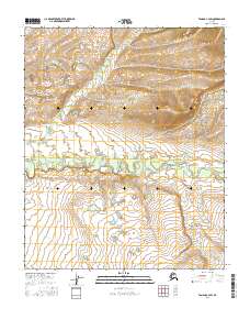
2016 Map of Tanana C-4 SW
USGS Topo · Published 2016About this map
Tozitna River meanders across the central portion of this interior landscape, marking a prominent hydrological feature in a region defined by its drainages. The river's winding path through the valley floor is joined by smaller tributaries like Crooked Cr, illustrating the complex water network that historically served as primary transportation corridors before the development of modern infrastructure. This 2016 survey by the U.S. Geological Survey documents the topography and natural boundaries of the Yukon-Koyukuk region, capturing the remote terrain in high detail. The lack of named settlements or road infrastructure emphasizes the wilderness character of the area, providing a clear baseline for researchers studying environmental changes or indigenous land use patterns within the vast Alaska interior.
Find a feature on this map
7 named features on this map. Tap any name to fly to it.
Don’t see what you’re looking for? This feature index may not catch every label — zoom into the map to look around manually.
Map Details
Editions of this 2016 Tanana C-4 SW Map
This is the sole edition of this map. No revisions or reprints were ever made.
Other maps of this area

1951 · Tanana
USGS Topo · 1:250,000

1956 · Tanana B-5
USGS Topo · 1:63,360

1956 · Tanana C-5
USGS Topo · 1:63,360

1956 · Tanana C-4
USGS Topo · 1:63,360

1956 · Tanana B-4
USGS Topo · 1:63,360

1956 · Tanana
USGS Topo · 1:250,000

1960 · Tanana
USGS Topo · 1:250,000
2016 · Tanana C-4 NW
USGS Topo · 1:25,000
2016 · Tanana B-5 NE
USGS Topo · 1:25,000
2016 · Tanana C-5 NE
USGS Topo · 1:25,000