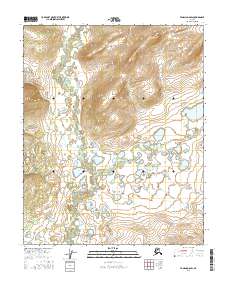
2016 Map of Tanana D-6 SW
USGS Topo · Published 2016About this map
The Melozitna River meanders through this interior Alaska landscape, defining a complex drainage system characterized by numerous small ponds and wetland basins. In this remote stretch of the Yukon-Koyukuk region, the river's path is joined by tributary streams including Slokhenjikh Cr and Nethkahati Cr. The terrain is marked by the distinct upland of Tohatokhet in the northwest, which provides a sharp contrast to the low-lying, water-saturated plains to the south.
Find a feature on this map
9 named features on this map. Tap any name to fly to it.
Don’t see what you’re looking for? This feature index may not catch every label — zoom into the map to look around manually.
Map Details
Editions of this 2016 Tanana D-6 SW Map
This is the sole edition of this map. No revisions or reprints were ever made.
Other maps of this area

1951 · Melozitna
USGS Topo · 1:250,000

1951 · Tanana
USGS Topo · 1:250,000

1952 · Melozitna D-1
USGS Topo · 1:63,360

1956 · Melozitna C-1
USGS Topo · 1:63,360

1956 · Tanana C-6
USGS Topo · 1:63,360

1956 · Tanana D-6
USGS Topo · 1:63,360

1956 · Melozitna
USGS Topo · 1:250,000

1956 · Tanana
USGS Topo · 1:250,000

1960 · Tanana
USGS Topo · 1:250,000
2016 · Tanana D-6 NE
USGS Topo · 1:25,000