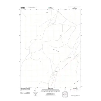
2010 Map of Tanner Creek Narrows
USGS Topo · Published 2010About this map
Champlin sits at the southern base of a desert landscape dominated by shifting sands and mountain ridges in Juab County. The terrain transitions from the White Sand Dunes in the northwest toward the high elevations of the Black Mountains and Gilson Mountains. Water management in this arid environment is traced through ephemeral features like Jericho Wash and the seasonal path of Tanner Creek, which carves through the distinct Tanner Creek Narrows. Public access and recreation are established through a network of sites including White Sands Campground, Jericho Campground, and Oasis Campground, all connected by the remote Jericho Callao Rd. This survey documents a sparsely populated but geographically diverse section of the Great Basin, where transportation and settlement patterns are dictated by the gap between the mountains.
Find a feature on this map
11 named features on this map. Tap any name to fly to it.
Don’t see what you’re looking for? This feature index may not catch every label — zoom into the map to look around manually.
Map Details
Editions of this 2010 Tanner Creek Narrows Map
This is the sole edition of this map. No revisions or reprints were ever made.
Other maps of this area

1885 · Sevier Desert
USGS Topo · 1:250,000

1953 · Delta
USGS Topo · 1:250,000

1954 · Mc Intyre
USGS Topo · 1:24,000

1958 · Delta
USGS Topo · 1:250,000

1962 · Delta
USGS Topo · 1:250,000

1962 · Lynndyl
USGS Topo · 1:62,500

1963 · Maple Peak
USGS Topo · 1:24,000

1963 · Cherry Creek
USGS Topo · 1:24,000

1967 · Champlin Peak
USGS Topo · 1:24,000
1967 · Jericho
USGS Topo · 1:24,000