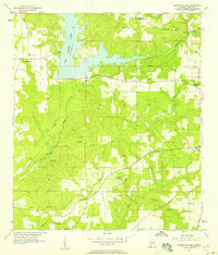
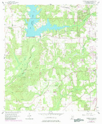
1957 Map of Tanner Williams
USGS Topo · Published 1958About this map
Big Creek Lake dominates the northern landscape of this western Mobile County region, showing the reservoir at its normal elevation of 109 feet. The surrounding rural terrain is defined by a network of family-named landmarks and small community centers that reflect the area's mid-century settlement patterns. To the west, the village of Tanner Williams serves as a local hub near several family burial grounds, including the Williams Cem and Dees Cem.
Find a feature on this map
33 named features on this map. Tap any name to fly to it.
Don’t see what you’re looking for? This feature index may not catch every label — zoom into the map to look around manually.
Map Details
Editions of this 1957 Tanner Williams Map
5 editions found
Other maps of this area

1922 · Mobile
USGS Topo · 1:62,500

1940 · Mobile
USGS Topo · 1:62,500

1941 · Hurley
USGS Topo · 1:62,500

1941 · Creola
USGS Topo · 1:62,500

1942 · Kushla
USGS Topo · 1:31,680

1942 · Theodore
USGS Topo · 1:31,680

1942 · Wilmer
USGS Topo · 1:62,500

1943 · Theodore
USGS Topo · 1:31,680

1943 · Creola
USGS Topo · 1:62,500

1943 · Hurley
USGS Topo · 1:62,500