
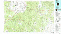
1983 Map of Taos
USGS Topo · Published 1983About this map
The Sangre de Cristo Mountains dominate this high-altitude landscape, where centuries of Spanish and Indigenous heritage converge. The sheet captures the historic hub of Taos and the neighboring Taos Pueblo Indian Reservation, alongside traditional villages like Ranchos de Taos, Talpa, and the high-mountain community of Truchas. This 1983 record reflects a region defined by its narrow valleys and vital waterways, including the Rio Grande and the Rio Pueblo de Taos.
Find a feature on this map
147 named features on this map. Tap any name to fly to it.
Don’t see what you’re looking for? This feature index may not catch every label — zoom into the map to look around manually.
Map Details
Editions of this 1983 Taos Map
2 editions found
Other maps of this area

1889 · Las Vegas
USGS Topo · 1:125,000

1889 · Santa Fe
USGS Topo · 1:125,000

1891 · Las Vegas
USGS Topo · 1:125,000

1892 · Santa Clara
USGS Topo · 1:125,000

1892 · Watrous
USGS Topo · 1:125,000

1893 · Las Vegas
USGS Topo · 1:125,000

1894 · Watrous
USGS Topo · 1:125,000

1894 · Santa Fe
USGS Topo · 1:125,000

1918 · Abiquiu
USGS Topo · 1:125,000

1918 · Tusas
USGS Topo · 1:125,000