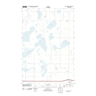
2011 Map of Tappen North
USGS Topo · Published 2011About this map
Glacial depressions and expansive wetlands dominate this portion of Kidder County, creating a complex hydrographic network characterized by scattered prairie potholes and larger water bodies. The terrain features prominent landmarks like McPhail Butte and the adjacent McPhail Slough, while the central portion of the landscape is defined by the connected waters of Mud Lake, Stony Lake, and Tappen Slough. These features illustrate the characteristic geological formation of the Missouri Coteau region, where internal drainage creates numerous seasonal and permanent lakes such as Big Muddy Lake and Bird Lake.
Find a feature on this map
32 named features on this map. Tap any name to fly to it.
Don’t see what you’re looking for? This feature index may not catch every label — zoom into the map to look around manually.
Map Details
Editions of this 2011 Tappen North Map
This is the sole edition of this map. No revisions or reprints were ever made.
Other maps of this area

1952 · Tappen South
USGS Topo · 1:24,000

1952 · Tappen SE
USGS Topo · 1:24,000

1952 · Tappen NE
USGS Topo · 1:24,000

1952 · Dawson
USGS Topo · 1:24,000

1952 · Tappen North
USGS Topo · 1:24,000

1952 · Steele NE
USGS Topo · 1:24,000

1952 · New Rockford
USGS Topo · 1:250,000

1953 · Jamestown
USGS Topo · 1:250,000

1956 · New Rockford
USGS Topo · 1:250,000

1956 · Jamestown
USGS Topo · 1:250,000