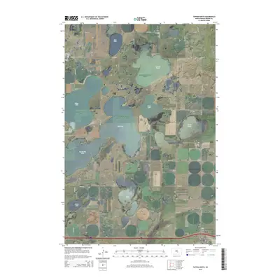
2014 Map of Tappen North
USGS Topo · Published 2014About this map
The low-lying wetlands of Kidder County dominate this 2014 survey, where a complex network of seasonal and permanent water bodies like Big Muddy Lake, Stony Lake, and Mud Lake define the prairie landscape. This region of North Dakota is characterized by its pothole lakes and glacial features, including McPhail Butte which rises above the surrounding McPhail Slough. The southern edge of the map shows the proximity of the small communities of Dawson and Tappen, linked by the corridor of CR-10. Local transportation and agriculture are supported by private and public infrastructure, evidenced by the M. Bodvig Airstrip to the north and the Tappen Airstrip near the town site. Genealogists may find interest in the Fisher Cem, located near the intersection of 36th St SE and 39th Ave SE, serving as a quiet landmark among the section-line roads that grid the expansive terrain.
Find a feature on this map
25 named features on this map. Tap any name to fly to it.
Don’t see what you’re looking for? This feature index may not catch every label — zoom into the map to look around manually.
Map Details
Editions of this 2014 Tappen North Map
This is the sole edition of this map. No revisions or reprints were ever made.
Other maps of this area
1952 · Tappen South
USGS Topo · 1:24,000
1952 · Tappen SE
USGS Topo · 1:24,000
1952 · Tappen NE
USGS Topo · 1:24,000
1952 · Dawson
USGS Topo · 1:24,000
1952 · Tappen North
USGS Topo · 1:24,000
1952 · Steele NE
USGS Topo · 1:24,000
1952 · New Rockford
USGS Topo · 1:250,000

1953 · Jamestown
USGS Topo · 1:250,000
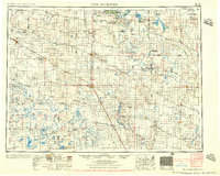
1956 · New Rockford
USGS Topo · 1:250,000

1956 · Jamestown
USGS Topo · 1:250,000