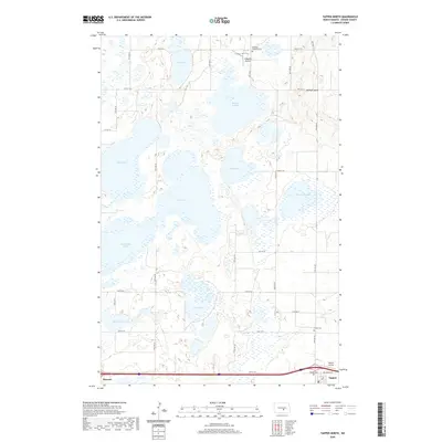
2020 Map of Tappen North
USGS Topo · Published 2020About this map
Glacial prairie potholes and extensive wetlands dominate this part of Kidder County, where the sprawling waters of Sibley Lake and Stony Lake reflect the unique hydrology of the Missouri Coteau. The landscape is a complex network of sloughs and basins, including McPhail Slough, Mud Lake, and Big Muddy Lake, which define the region's character. In the southern reach, the small communities of Dawson and Tappen sit along the primary transport corridor, serving as local hubs in an area otherwise dedicated to section-line roads and open ranch land.
Find a feature on this map
33 named features on this map. Tap any name to fly to it.
Don’t see what you’re looking for? This feature index may not catch every label — zoom into the map to look around manually.
Map Details
Editions of this 2020 Tappen North Map
This is the sole edition of this map. No revisions or reprints were ever made.
Other maps of this area

1952 · Tappen South
USGS Topo · 1:24,000

1952 · Tappen SE
USGS Topo · 1:24,000

1952 · Tappen NE
USGS Topo · 1:24,000

1952 · Dawson
USGS Topo · 1:24,000

1952 · Tappen North
USGS Topo · 1:24,000

1952 · Steele NE
USGS Topo · 1:24,000

1952 · New Rockford
USGS Topo · 1:250,000

1953 · Jamestown
USGS Topo · 1:250,000

1956 · New Rockford
USGS Topo · 1:250,000

1956 · Jamestown
USGS Topo · 1:250,000