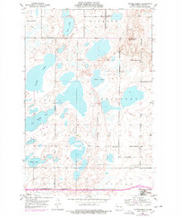
1975 Map of Tappen North
USGS Topo · Published 1978About this map
Sibley Lake and a dense network of smaller basins like Bird Lake and Stony Lake define this prairie landscape in Kidder County. The map reflects a mid-1970s view of the area, with revisions highlighted in purple over a 1950s base. This era captures the transition of rural education and community life, marked by scattered schoolhouses such as School No 2 and School No 3, alongside the Norwegian Ch and Fisher Cem.
Find a feature on this map
22 named features on this map. Tap any name to fly to it.
Don’t see what you’re looking for? This feature index may not catch every label — zoom into the map to look around manually.
Map Details
Editions of this 1975 Tappen North Map
This is the sole edition of this map. No revisions or reprints were ever made.
Other maps of this area

1952 · Tappen South
USGS Topo · 1:24,000

1952 · Tappen SE
USGS Topo · 1:24,000

1952 · Tappen NE
USGS Topo · 1:24,000

1952 · Dawson
USGS Topo · 1:24,000

1952 · Tappen North
USGS Topo · 1:24,000

1952 · Steele NE
USGS Topo · 1:24,000

1952 · New Rockford
USGS Topo · 1:250,000

1953 · Jamestown
USGS Topo · 1:250,000

1956 · New Rockford
USGS Topo · 1:250,000

1956 · Jamestown
USGS Topo · 1:250,000