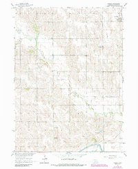
1966 Map of Tarnov
USGS Topo · Published 1985About this map
Tarnov and the agricultural lands of Platte County are defined by a network of rural institutions and drainage patterns in this mid-century survey. The settlement of Tarnov sits in the northeast corner along the Union Pacific tracks, anchored by St Michaels Cem. The surrounding landscape is a mosaic of family-named landmarks and essential community centers, from Postville Ch and St Anthonys Ch to several small burial grounds like Burrows Cem and Zion Cem.
Find a feature on this map
14 named features on this map. Tap any name to fly to it.
Don’t see what you’re looking for? This feature index may not catch every label — zoom into the map to look around manually.
Map Details
Editions of this 1966 Tarnov Map
2 editions found
Other maps of this area

1896 · Stromsburg
USGS Topo · 1:125,000

1899 · David City
USGS Topo · 1:125,000

1955 · Fremont
USGS Topo · 1:250,000

1957 · Fremont
USGS Topo · 1:250,000

1958 · Fremont
USGS Topo · 1:250,000

1958 · Genoa
USGS Topo · 1:24,000

1958 · Monroe
USGS Topo · 1:24,000

1958 · Duncan
USGS Topo · 1:24,000

1966 · Tarnov
USGS Topo · 1:24,000
1966 · Lindsay SW
USGS Topo · 1:24,000