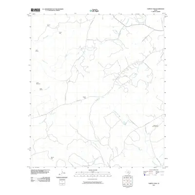
2010 Map of Tarpley Pass
USGS Topo · Published 2010About this map
El Paraiso Ranch and several family-named roads anchor this portion of the Texas Hill Country, where the landscape is defined by its dramatic limestone relief and seasonal watercourses. The drainage patterns of Winans Creek, Middle Verde Creek, and Bandera Creek cut through the rugged terrain, creating significant landmarks such as Lovers Leap and Chalk Mountain.
Find a feature on this map
31 named features on this map. Tap any name to fly to it.
Don’t see what you’re looking for? This feature index may not catch every label — zoom into the map to look around manually.
Map Details
Editions of this 2010 Tarpley Pass Map
This is the sole edition of this map. No revisions or reprints were ever made.
Other maps of this area

1954 · San Antonio
USGS Topo · 1:250,000

1956 · Tarpley
USGS Topo · 1:62,500

1956 · Tuff
USGS Topo · 1:62,500

1956 · Bandera
USGS Topo · 1:62,500

1956 · Center Point
USGS Topo · 1:62,500

1957 · San Antonio
USGS Topo · 1:250,000

1964 · Bandera
USGS Topo · 1:24,000

1964 · Timber Creek
USGS Topo · 1:24,000

1964 · Rock Cliff Reservoir
USGS Topo · 1:24,000
1964 · A Bar A Ranch
USGS Topo · 1:24,000