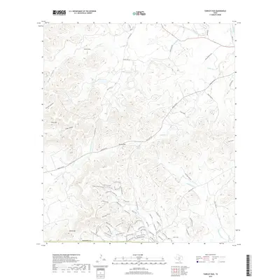
2019 Map of Tarpley Pass
USGS Topo · Published 2019About this map
Tarpley Pass anchors a landscape defined by significant elevation changes and seasonal watercourses in this 2019 survey. The terrain is marked by prominent landmarks such as Chalk Mtn and Lovers Leap, while numerous gaps and hollows like Barnes Gap and Bishop Hollow dictate the local travel routes. The map illustrates a complex network of private ranch roads and trails, including Kyle Ranch Rd and Pingleton Ranch Rd, which weave through the drainage basins of Winans Cr and Indian Cr.
Find a feature on this map
58 named features on this map. Tap any name to fly to it.
Don’t see what you’re looking for? This feature index may not catch every label — zoom into the map to look around manually.
Map Details
Editions of this 2019 Tarpley Pass Map
This is the sole edition of this map. No revisions or reprints were ever made.
Other maps of this area
1954 · San Antonio
USGS Topo · 1:250,000
1956 · Tarpley
USGS Topo · 1:62,500
1956 · Tuff
USGS Topo · 1:62,500
1956 · Bandera
USGS Topo · 1:62,500
1956 · Center Point
USGS Topo · 1:62,500
1957 · San Antonio
USGS Topo · 1:250,000
1964 · Bandera
USGS Topo · 1:24,000
1964 · Timber Creek
USGS Topo · 1:24,000
1964 · Rock Cliff Reservoir
USGS Topo · 1:24,000
1964 · A Bar A Ranch
USGS Topo · 1:24,000