
1943 Map of Tarpon Springs
USGS Topo · Published 1943About this map
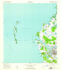
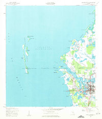
Tarpon Springs serves as the focal point of this coastal landscape, situated where the Anclote River flows into the protected waters of the Anclote Anchorage. The 1943 shoreline reveals a complex network of coastal inlets and bayous, including Whitcomb Bayou and Tarpon Bayou, which reflect the early maritime orientation of the community before mid-century expansion. Along the coast, Sponge Harbor Pt hints at the area's specialized industry and seafaring history.
Find a feature on this map
57 named features on this map. Tap any name to fly to it.
Don’t see what you’re looking for? This feature index may not catch every label — zoom into the map to look around manually.
Map Details
Editions of this 1943 Tarpon Springs Map
3 editions found
Other maps of this area

1943 · Dunedin
USGS Topo · 1:31,680

1943 · Elfers
USGS Topo · 1:24,000

1943 · Oldsmar
USGS Topo · 1:24,000

1944 · Elfers
USGS Topo · 1:31,680

1944 · Oldsmar
USGS Topo · 1:31,680

1948 · Elfers
USGS Topo · 1:25,000

1954 · Port Richey
USGS Topo · 1:24,000

1955 · Plant City
USGS Topo · 1:250,000

1958 · Plant City
USGS Topo · 1:250,000

1959 · Plant City
USGS Topo · 1:250,000