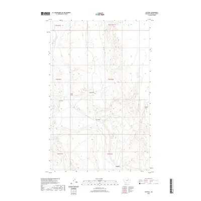
2020 Map of Tattnall
USGS Topo · Published 2020About this map
The settlement of Tattnall sits in the southern portion of this Phillips County landscape, characterized by the intricate drainage patterns of the Northern Plains. The area is defined by numerous coulees that carve through the terrain, including Gregory Coulee, Coop Coulee, and Lush Coulee in the northwest, and Joe Bell Coulee to the east. These intermittent watercourses and topographic depressions shape the local geography, centering on Clark Coulee which meanders through the heart of the territory. The map illustrates a sparse, ranching-oriented environment where life is dictated by the availability of water and the natural contours of the land, providing a clear view of the rural Montana infrastructure and survey townships during the early 21st century.
Find a feature on this map
17 named features on this map. Tap any name to fly to it.
Don’t see what you’re looking for? This feature index may not catch every label — zoom into the map to look around manually.
Map Details
Editions of this 2020 Tattnall Map
This is the sole edition of this map. No revisions or reprints were ever made.
Other maps of this area
1920 · Cowan
USGS Topo · 1:125,000

1954 · Glasgow
USGS Topo · 1:250,000

1957 · Glasgow
USGS Topo · 1:250,000

1958 · Glasgow
USGS Topo · 1:250,000
1968 · Tattnall
USGS Topo · 1:24,000
1968 · Hewitt Lake
USGS Topo · 1:24,000
1968 · Austin Lake
USGS Topo · 1:24,000
1968 · Hewitt Lake SW
USGS Topo · 1:24,000
1984 · Cole
USGS Topo · 1:24,000
1984 · Whitewater East
USGS Topo · 1:24,000