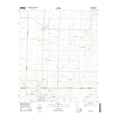
2014 Map of Taylor
USGS Topo · Published 2014About this map
Springhill anchors the southern boundary of this 2014 survey, where the Louisiana state line meets the Arkansas border. This industrial and residential hub is defined by its proximity to the Springhill Oil Field and the North Shongaloo Oil and Gas Field, reflecting the region's long-standing reliance on energy extraction. The landscape to the north is a mix of small settlements like Welcome and Walnut Grove, connected by a network of rural routes such as Columbia Road 21.
Find a feature on this map
51 named features on this map. Tap any name to fly to it.
Don’t see what you’re looking for? This feature index may not catch every label — zoom into the map to look around manually.
Map Details
Editions of this 2014 Taylor Map
This is the sole edition of this map. No revisions or reprints were ever made.
Other maps of this area

1922 · Sarepta
USGS Topo · 1:62,500

1924 · Sarepta
USGS Topo · 1:62,500

1950 · Plain Dealing NE
USGS Topo · 1:31,680

1952 · Bradley NE
USGS Topo · 1:24,000

1952 · Bradley SE
USGS Topo · 1:24,000

1953 · Carterville
USGS Topo · 1:24,000

1953 · El Dorado
USGS Topo · 1:250,000

1955 · Shreveport
USGS Topo · 1:250,000
1955 · Plain Dealing
USGS Topo · 1:62,500

1956 · Shreveport
USGS Topo · 1:250,000