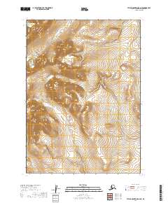
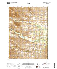
2019 Map of Taylor Mountains B-6 NE
USGS Topo · Published 2019About this map
The interior of the Dillingham Census Area is defined by high-elevation terrain and complex hydrological systems, as shown in this 2019 survey. The map outlines the boundaries of several townships, including T5n R50w and T4n R50w, where the landscape is dominated by a dense network of mountain ridges and drainage basins. With a 20-foot contour interval, the topography reveals the intricate descent of unnamed streams from the central peaks down toward the surrounding valley systems.
Find a feature on this map
6 named features on this map. Tap any name to fly to it.
Don’t see what you’re looking for? This feature index may not catch every label — zoom into the map to look around manually.
Map Details
Editions of this 2019 Taylor Mountains B-6 NE Map
This is the sole edition of this map. No revisions or reprints were ever made.
Other maps of this area

1950 · Taylor Mountains
USGS Topo · 1:250,000

1951 · Taylor Mountains
USGS Topo · 1:250,000

1954 · Taylor Mountains
USGS Topo · 1:250,000

1954 · Taylor Mountains B-5
USGS Topo · 1:63,360
1954 · Taylor Mountains C-5
USGS Topo · 1:63,360

1954 · Taylor Mountains B-6
USGS Topo · 1:63,360

1954 · Taylor Mountains C-6
USGS Topo · 1:63,360
2019 · Taylor Mountains C-6 SE
USGS Topo · 1:25,000
2019 · Taylor Mountains B-5 SW
USGS Topo · 1:25,000
2019 · Taylor Mountains B-6 SE
USGS Topo · 1:25,000