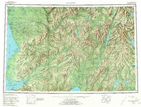
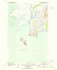
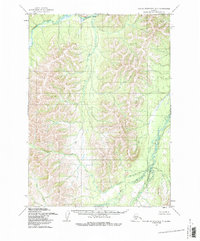
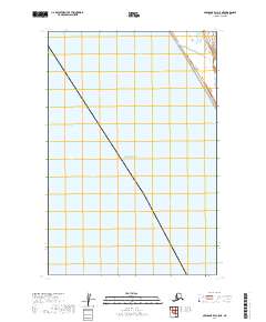
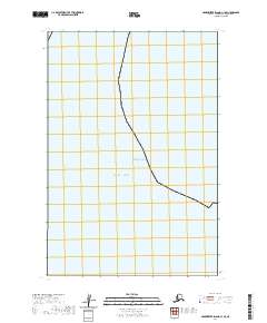
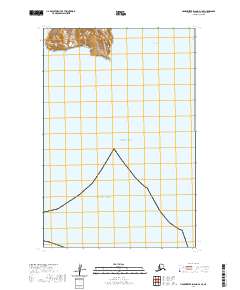
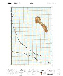
1951 Map of Taylor Mountains
USGS Topo · Published 1951About this map
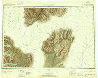
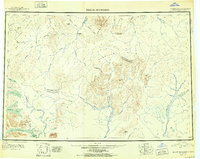
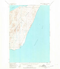
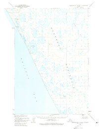
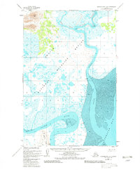
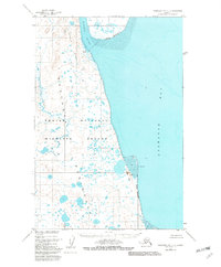
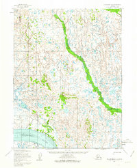
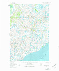
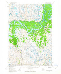
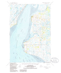
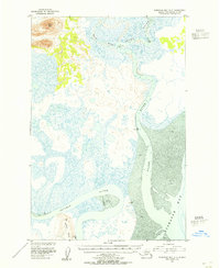
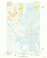
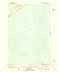
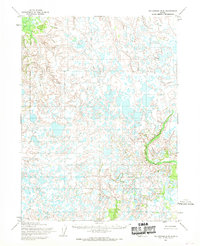
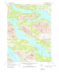
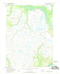
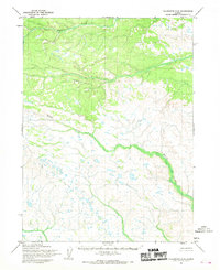
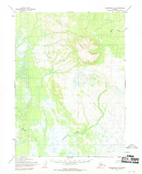
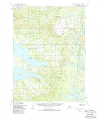
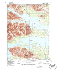
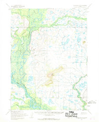
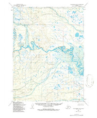
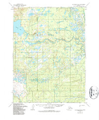
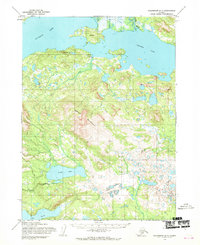
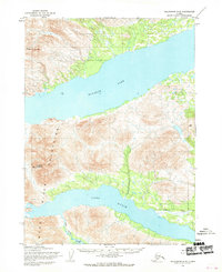
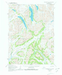
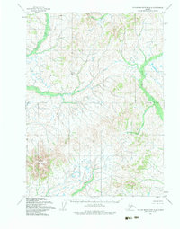
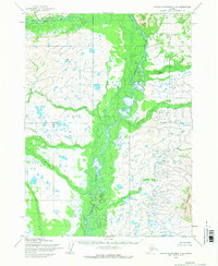
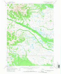
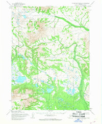
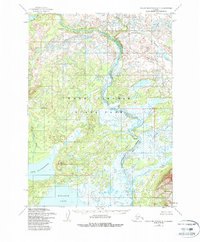
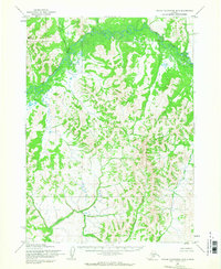
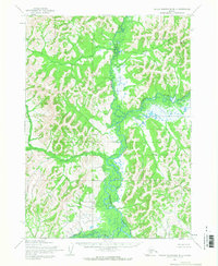
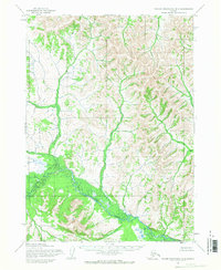
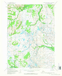
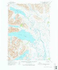
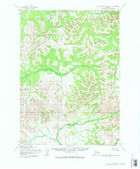
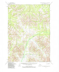
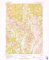
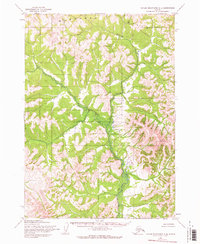
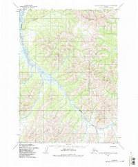
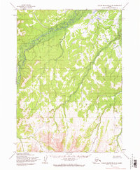
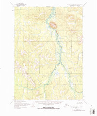
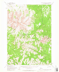
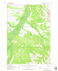
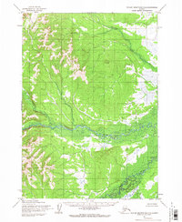
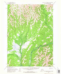
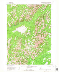
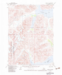
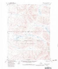
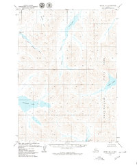
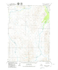
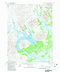
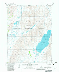
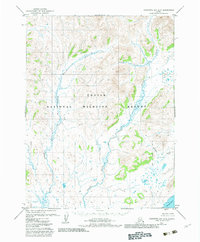
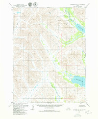
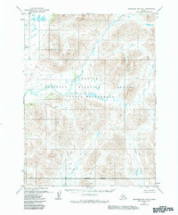
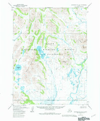
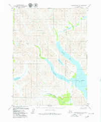
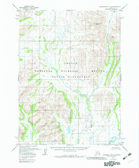
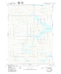
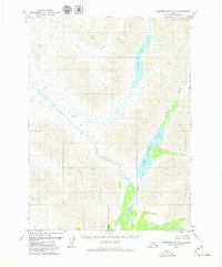
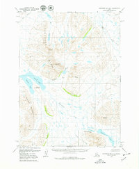
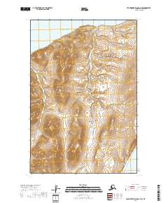
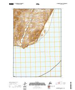
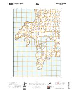
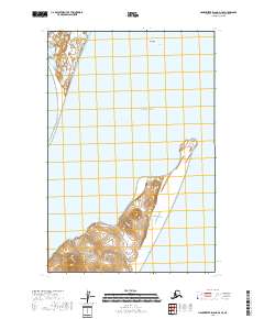
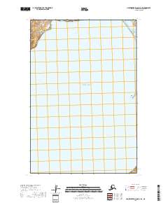
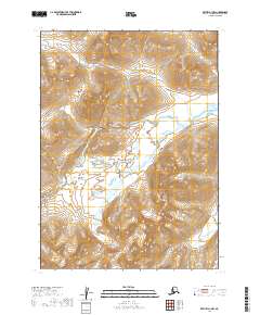
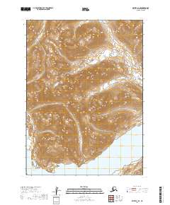
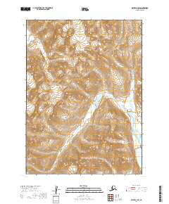
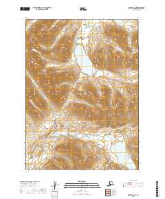
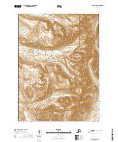
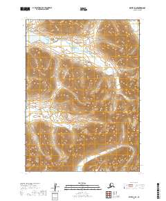
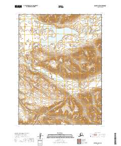
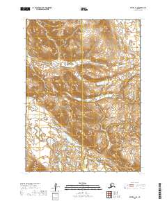
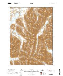
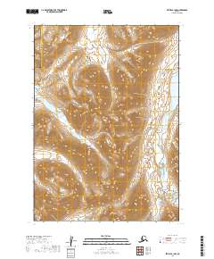
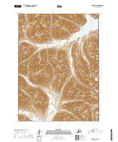
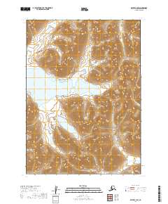
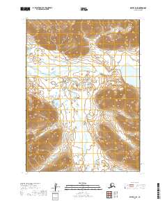
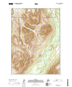
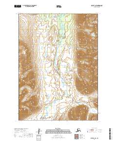
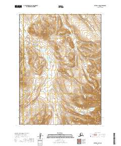
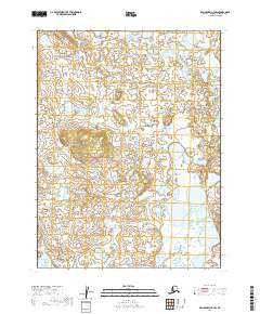
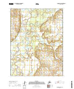
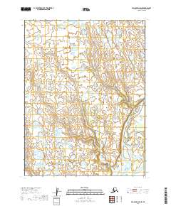
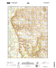
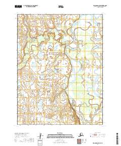
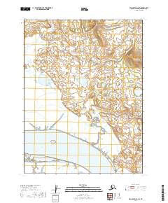
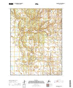
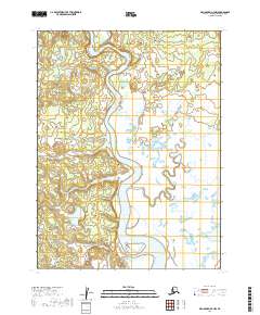
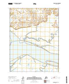
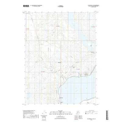
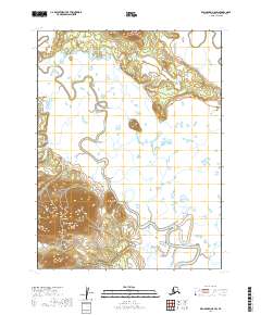
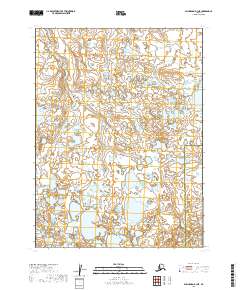
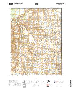
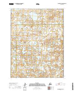
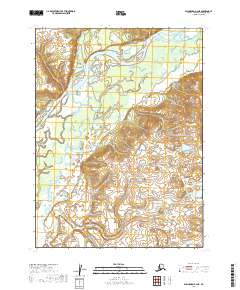
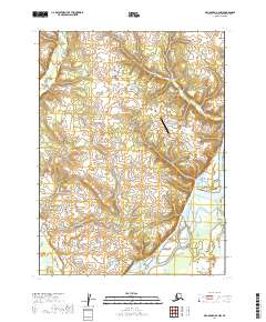
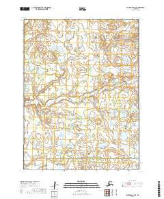
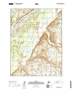
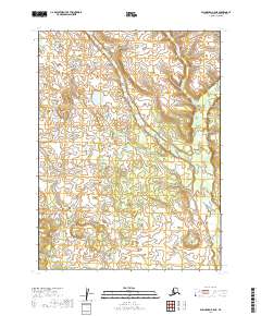
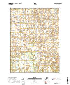
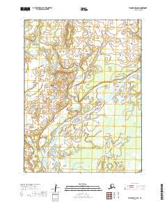
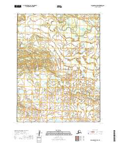
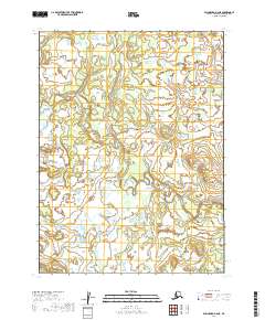
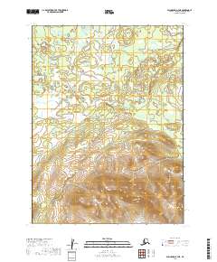
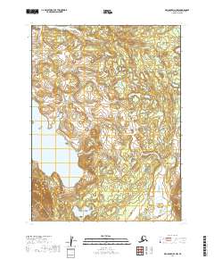
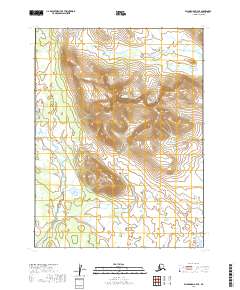
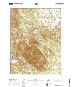
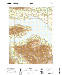
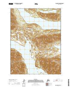
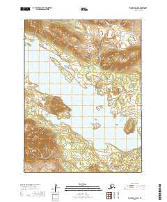
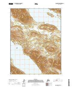
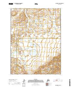
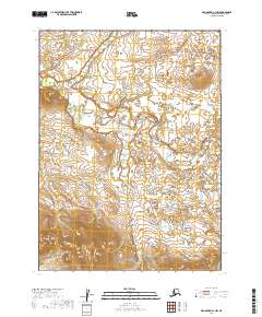
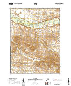
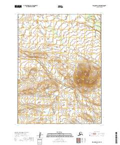
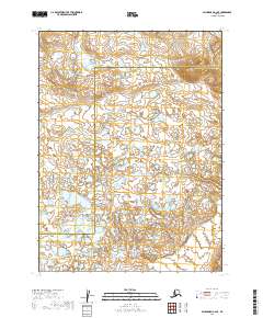
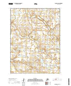
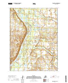
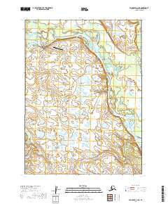
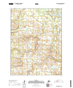
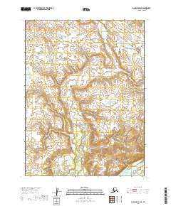
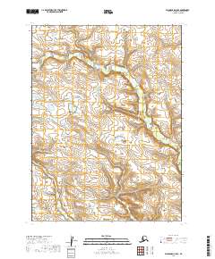
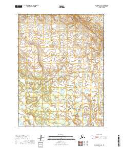
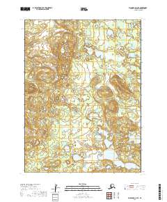
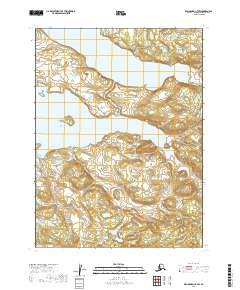
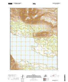
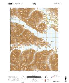
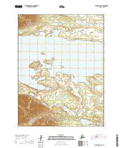
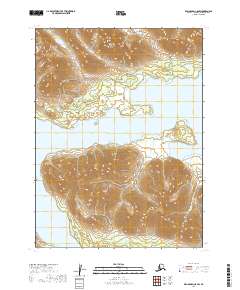
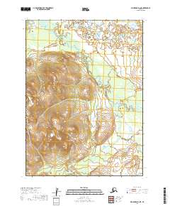
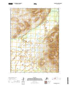
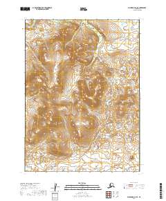
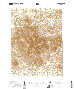
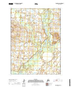
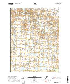
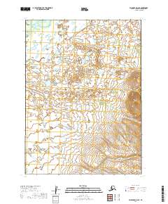
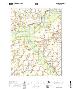
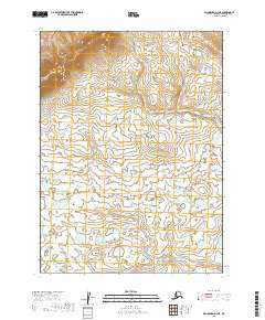
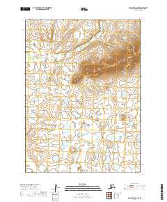
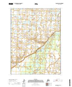
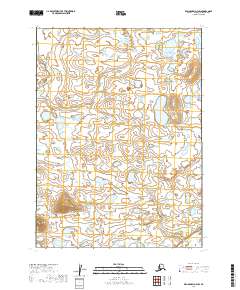
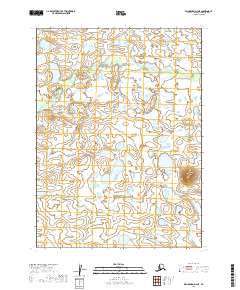
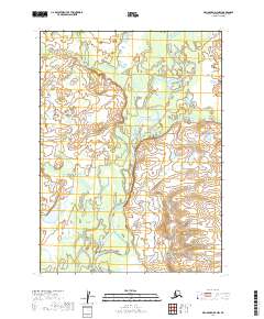
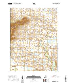
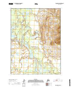
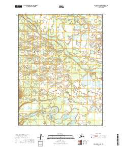
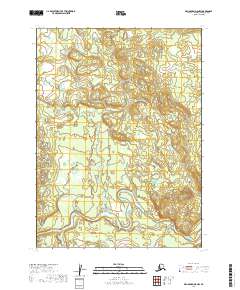
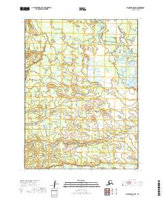
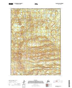
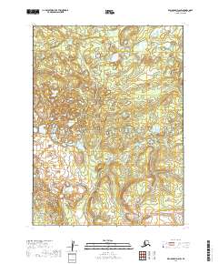
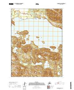
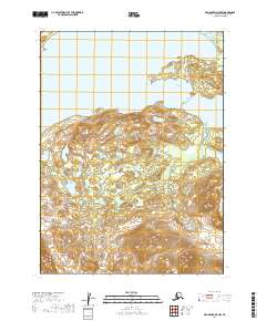
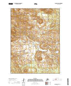
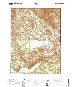
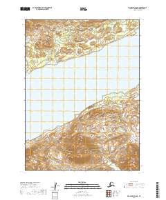
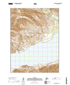
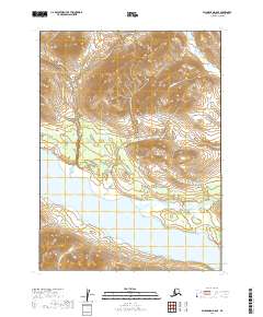
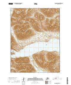
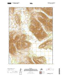
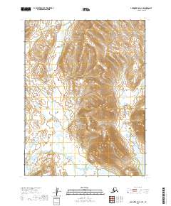
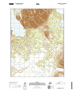
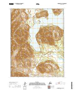
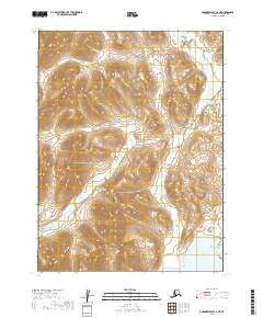
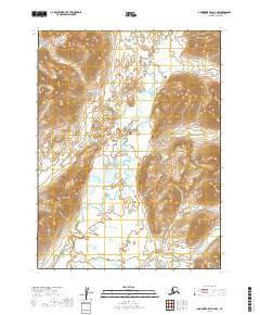
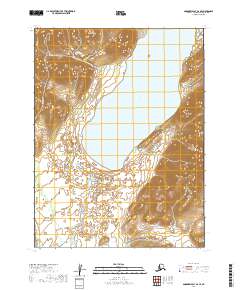
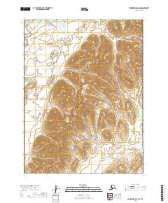
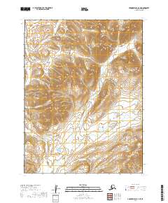
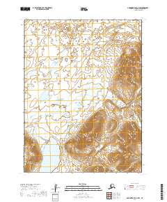
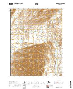
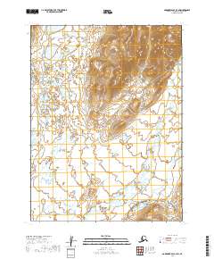
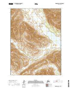
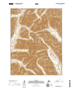
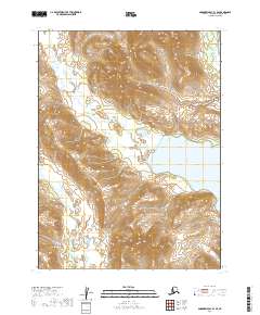
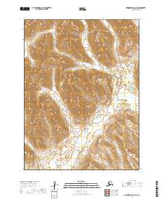
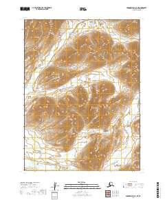
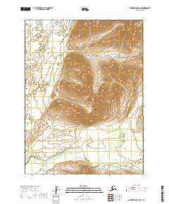
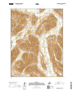
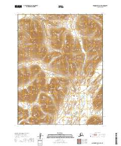
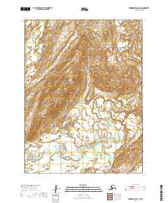
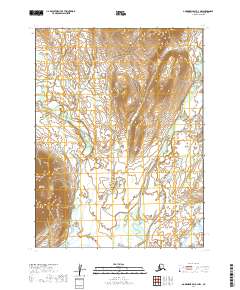
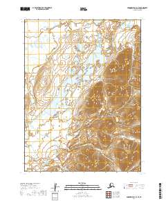
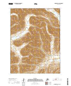
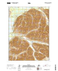
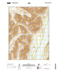
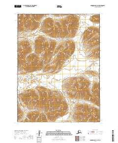
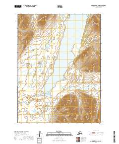
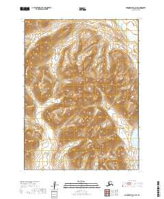
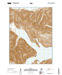
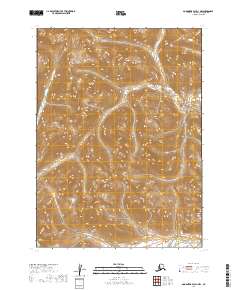
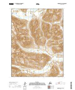
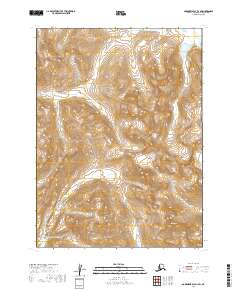
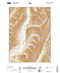
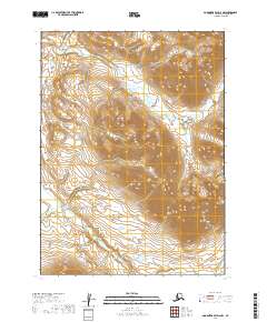
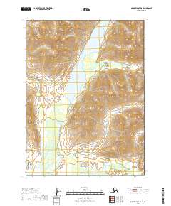
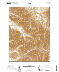
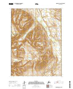
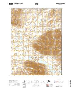
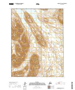
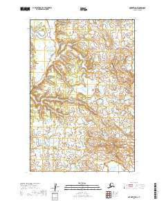
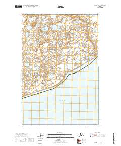
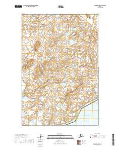
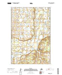
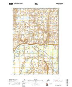
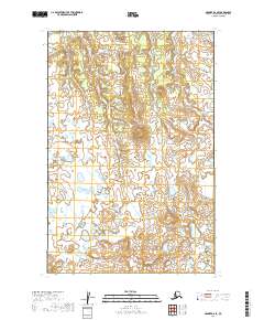
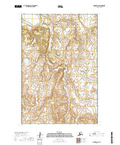
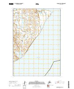
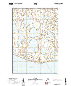
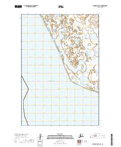
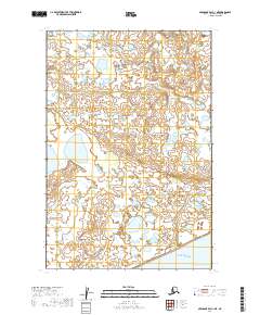
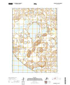
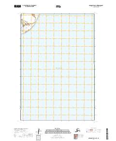
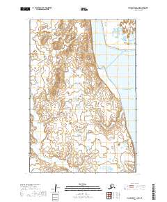
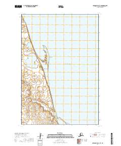
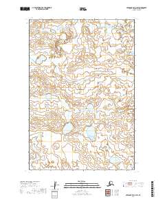
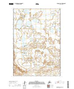
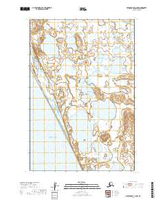
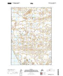
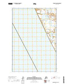
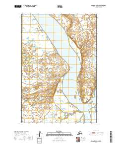
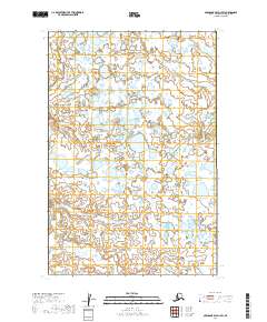
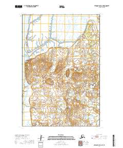
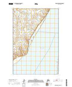
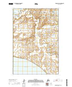
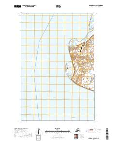
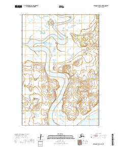
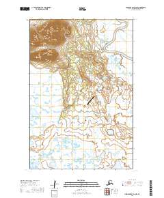
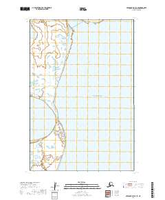
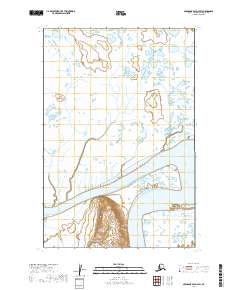
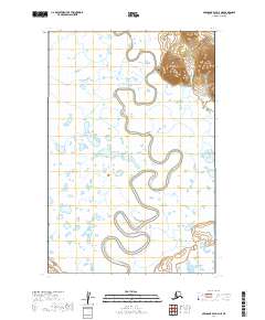
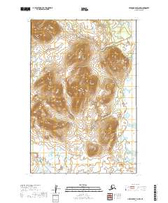
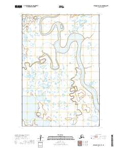
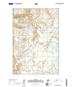
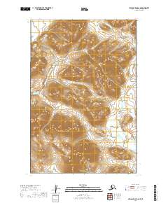
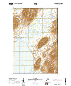
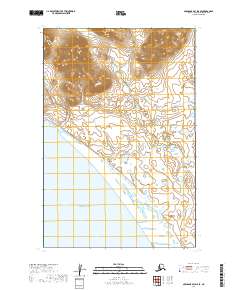
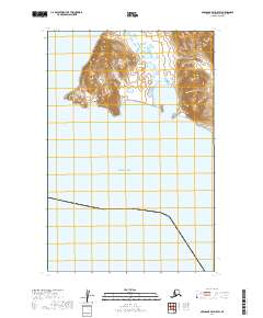
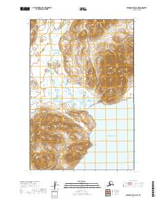
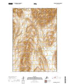
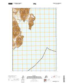
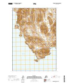
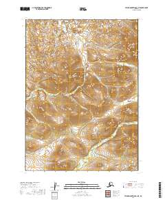
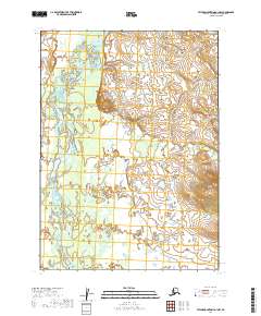
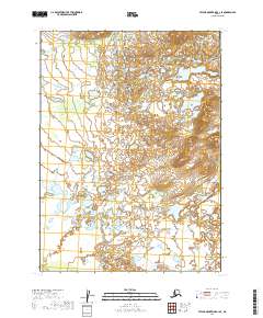
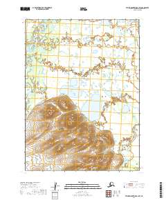
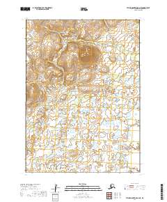
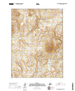
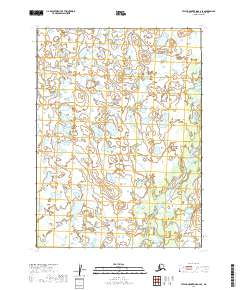
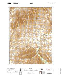
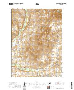
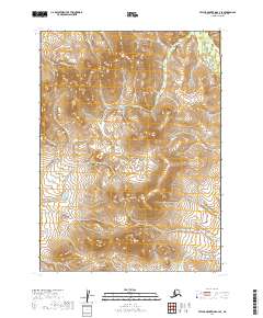
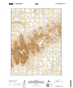
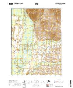
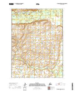
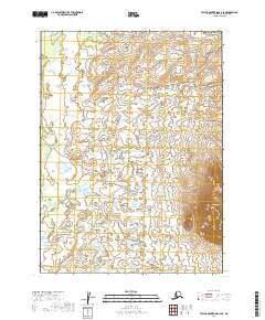
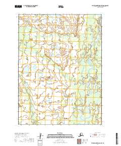
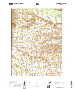
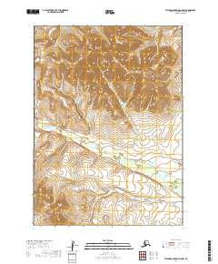
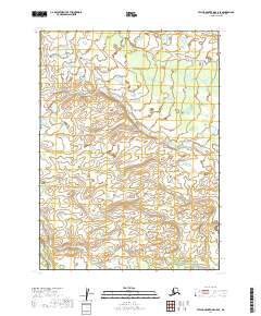
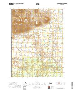
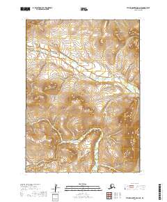
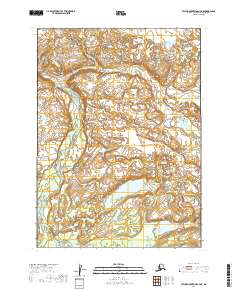
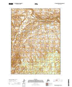
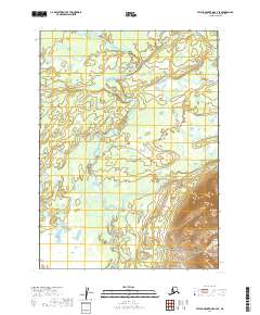
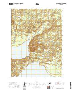
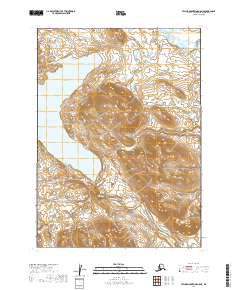
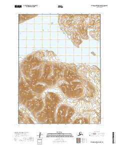
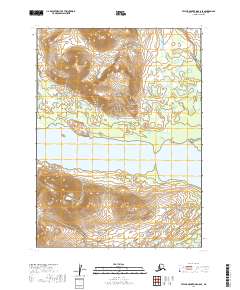
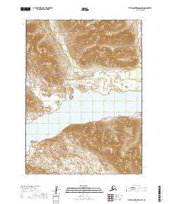
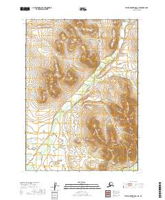
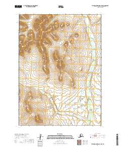
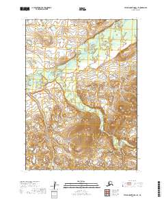
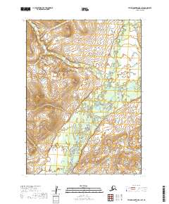
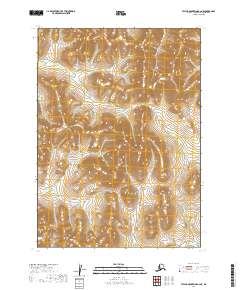
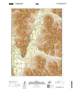
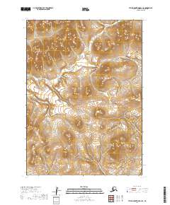
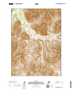
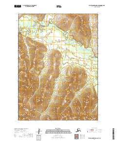
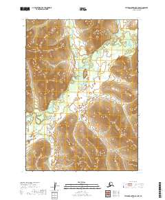
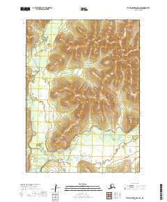
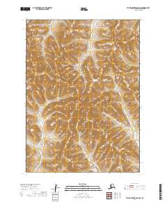
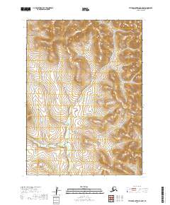
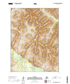
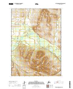
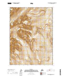
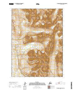
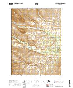
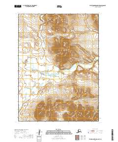
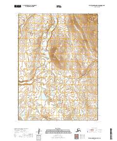
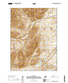
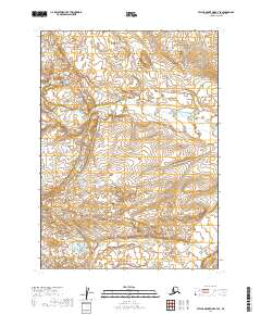
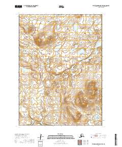
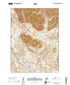
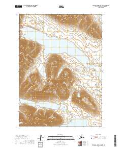
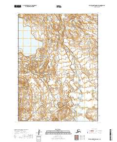
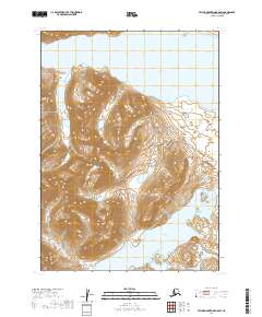
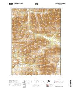
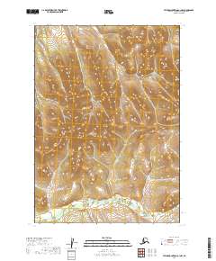
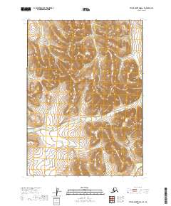
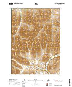
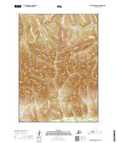
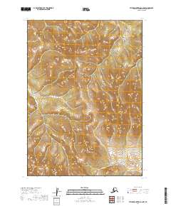
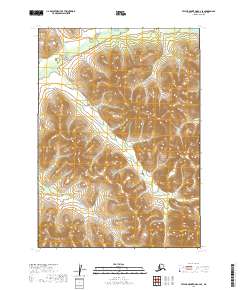
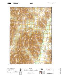
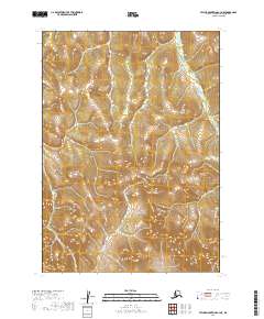
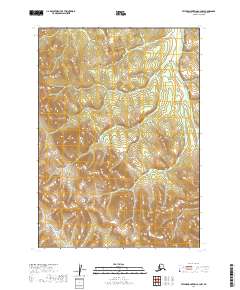
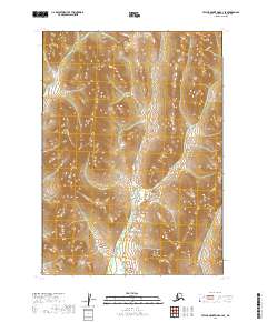
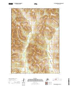
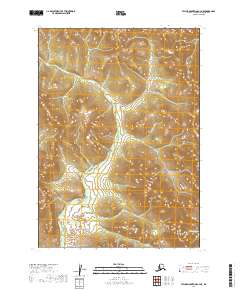
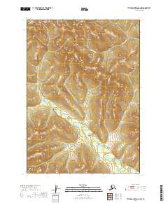
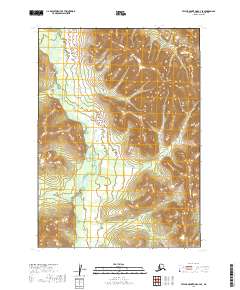
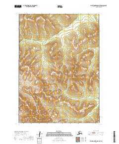
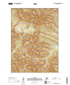
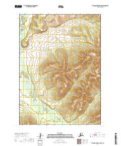
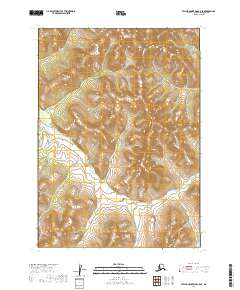
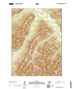
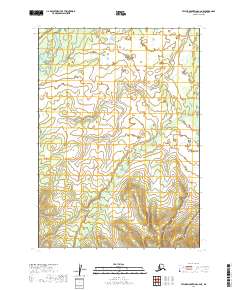
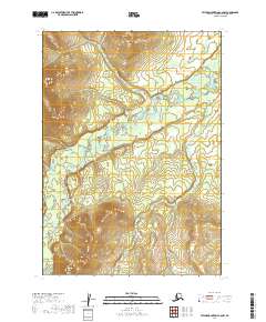
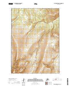
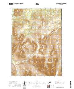
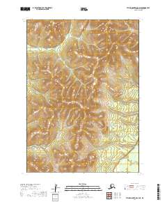
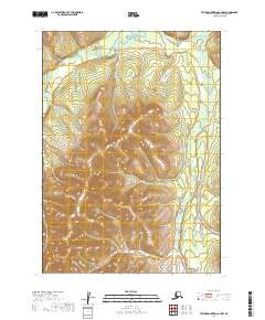
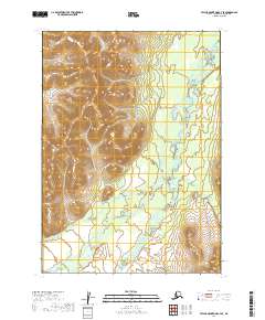
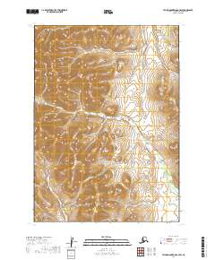
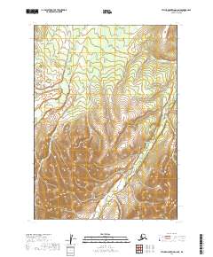
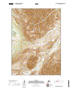
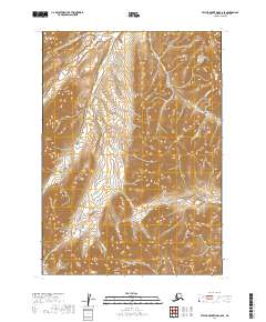
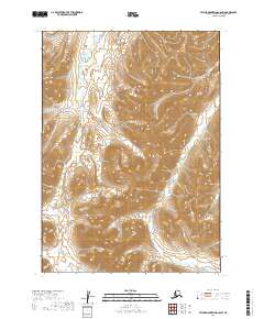
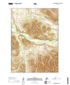
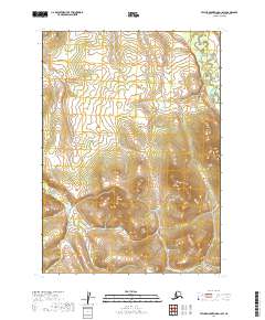
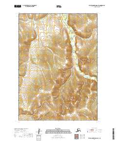
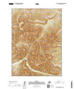
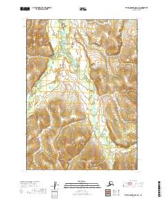
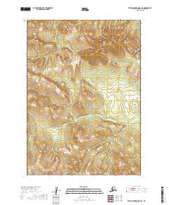
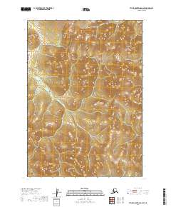
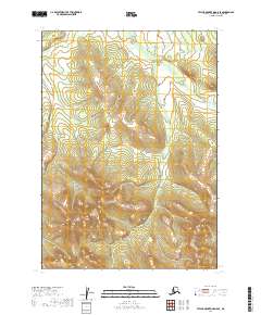
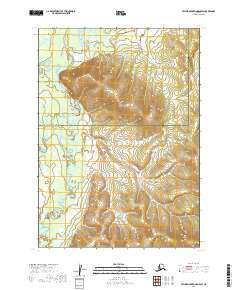
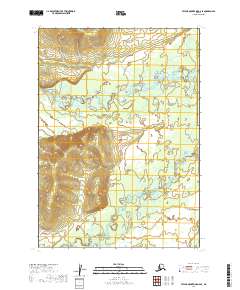
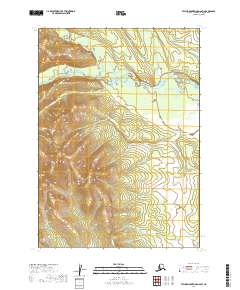
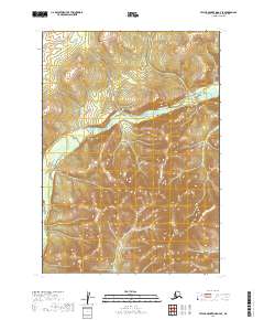
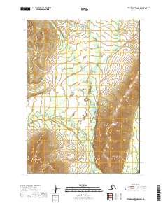
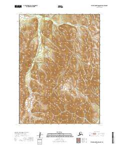
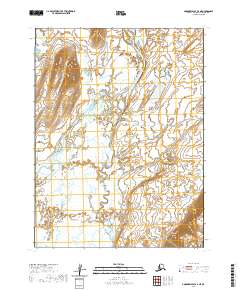
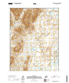
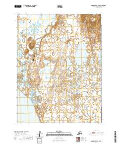
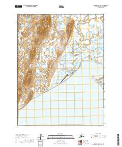
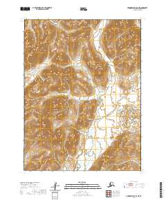
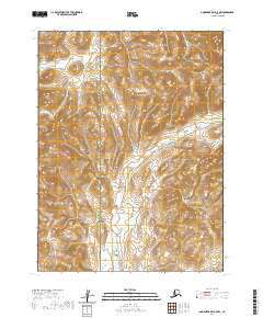
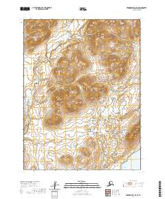
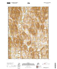
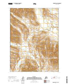
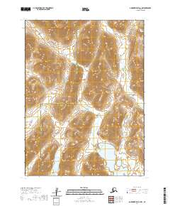
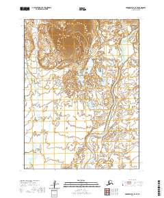
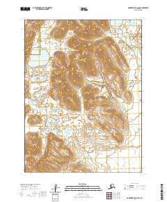
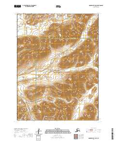
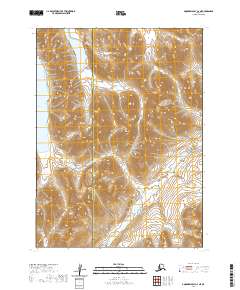
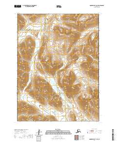
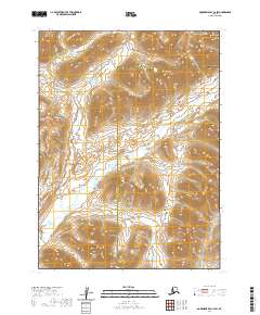
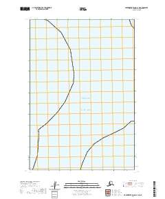
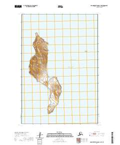
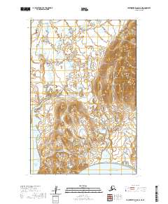
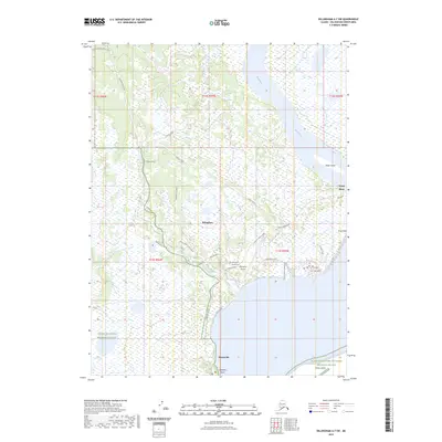
Kashegelok stands as a focal point of settlement in this remote interior landscape, situated near the confluence of the Makatulik Creek and the Chukowan River. This 1951 compilation, drawn from Trimetrogon photography and earlier surveys, reveals a vast network of waterways dominated by the Nushagak River and the Mulchatna River system. The southwestern portion of the map is defined by a chain of significant water bodies, including Nishlik Lake, Upnuk Lake, and Tikchik Lake, which are nestled among the high peaks of the Kuskokwim Mountains.
Find a feature on this map
53 named features on this map. Tap any name to fly to it.
Don’t see what you’re looking for? This feature index may not catch every label — zoom into the map to look around manually.
Map Details
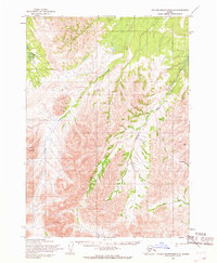
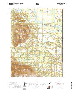
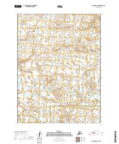
Editions of this 1951 Taylor Mountains Map
2 editions found
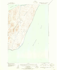
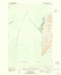
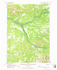
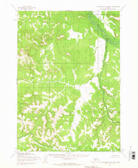
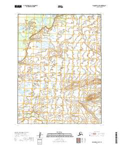
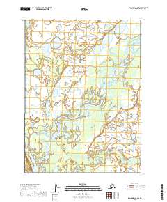
Historical Maps of Kashegelok Through Time
487 maps found
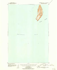
1947 Hagemeister Island D-2
Dillingham Borough, AK

1948 Hagemeister Island C-1
Dillingham Borough, AK
1948 Hagemeister Island C-2
Dillingham Borough, AK
1948 Hagemeister Island C-3
Dillingham Borough, AK
1948 Hagemeister Island C-4
Dillingham Borough, AK
1948 Hagemeister Island D-3
Dillingham Borough, AK
1948 Nushagak Bay C-4 And C-5
Dillingham Borough, AK
1948 Nushagak Bay D-3
Dillingham Borough, AK

1948 Nushagak Bay D-4
Dillingham Borough, AK
1950 Hagemeister Island D-1
Dillingham Borough, AK
1950 Nushagak Bay B-3
Dillingham Borough, AK
1950 Nushagak Bay B-4
Dillingham Borough, AK
1950 Nushagak Bay C-3
Dillingham Borough, AK
1950 Nushagak Bay C-4 And C-5
Dillingham Borough, AK
1950 Nushagak Bay D-5
Dillingham Borough, AK
1950 Nushagak Bay D-6
Dillingham Borough, AK

1950 Taylor Mountains
Dillingham Borough, AK
1951 Goodnews
Dillingham Borough, AK
1951 Hagemeister Island
Dillingham Borough, AK
1951 Taylor Mountains
Dillingham Borough, AK
1952 Dillingham A-4
Dillingham Borough, AK
1952 Dillingham A-5
Dillingham Borough, AK
1952 Dillingham A-6
Dillingham Borough, AK
1952 Dillingham A-7
Dillingham Borough, AK
1952 Dillingham A-8
Dillingham Borough, AK
1952 Hagemeister Island C-1
Dillingham Borough, AK
1952 Hagemeister Island C-2
Dillingham Borough, AK
1952 Hagemeister Island C-3
Dillingham Borough, AK
1952 Hagemeister Island C-4
Dillingham Borough, AK
1952 Hagemeister Island D-1
Dillingham Borough, AK
1952 Naknek D-5
Dillingham Borough, AK
1952 Naknek D-6
Dillingham Borough, AK
1952 Nushagak Bay C-1
Dillingham Borough, AK
1952 Nushagak Bay D-1
Dillingham Borough, AK
1952 Nushagak Bay D-2
Dillingham Borough, AK
1952 Nushagak Bay D-3
Dillingham Borough, AK
1952 Nushagak Bay D-4
Dillingham Borough, AK
1953 Hagemeister Island D-2
Dillingham Borough, AK
1954 Dillingham B-3
Dillingham Borough, AK
1954 Dillingham B-4
Dillingham Borough, AK

1954 Dillingham B-5
Dillingham Borough, AK
1954 Dillingham B-6
Dillingham Borough, AK
1954 Dillingham B-7
Dillingham Borough, AK
1954 Dillingham B-8
Dillingham Borough, AK
1954 Dillingham C-1
Dillingham Borough, AK
1954 Dillingham C-2
Dillingham Borough, AK
1954 Dillingham C-3
Dillingham Borough, AK
1954 Dillingham C-4
Dillingham Borough, AK
1954 Dillingham C-5
Dillingham Borough, AK
1954 Dillingham C-6
Dillingham Borough, AK
1954 Dillingham C-7
Dillingham Borough, AK
1954 Dillingham C-8
Dillingham Borough, AK
1954 Dillingham D-1
Dillingham Borough, AK
1954 Dillingham D-2
Dillingham Borough, AK
1954 Dillingham D-3
Dillingham Borough, AK
1954 Dillingham D-4
Dillingham Borough, AK
1954 Dillingham D-5
Dillingham Borough, AK
1954 Dillingham D-6
Dillingham Borough, AK
1954 Dillingham D-7
Dillingham Borough, AK
1954 Dillingham D-8
Dillingham Borough, AK
1954 Goodnews A-3
Dillingham Borough, AK
1954 Goodnews B-3
Dillingham Borough, AK
1954 Goodnews Bay A-4
Dillingham Borough, AK
1954 Goodnews Bay C-4
Dillingham Borough, AK
1954 Goodnews C-2
Dillingham Borough, AK
1954 Taylor Mountains A-1
Dillingham Borough, AK
1954 Taylor Mountains A-2
Dillingham Borough, AK
1954 Taylor Mountains A-3
Dillingham Borough, AK
1954 Taylor Mountains A-4
Dillingham Borough, AK
1954 Taylor Mountains A-5
Dillingham Borough, AK
1954 Taylor Mountains A-6
Dillingham Borough, AK
1954 Taylor Mountains A-7
Dillingham Borough, AK
1954 Taylor Mountains A-8
Dillingham Borough, AK
1954 Taylor Mountains B-1
Dillingham Borough, AK
1954 Taylor Mountains B-2
Dillingham Borough, AK
1954 Taylor Mountains B-3
Dillingham Borough, AK
1954 Taylor Mountains B-4
Dillingham Borough, AK
1954 Taylor Mountains B-5
Dillingham Borough, AK
1954 Taylor Mountains B-6
Dillingham Borough, AK
1954 Taylor Mountains B-7
Dillingham Borough, AK
1954 Taylor Mountains B-8
Dillingham Borough, AK
1954 Taylor Mountains C-1
Dillingham Borough, AK
1954 Taylor Mountains C-2
Dillingham Borough, AK
1954 Taylor Mountains C-3
Dillingham Borough, AK
1954 Taylor Mountains C-4
Dillingham Borough, AK
1954 Taylor Mountains C-5
Dillingham Borough, AK
1954 Taylor Mountains C-6
Dillingham Borough, AK
1954 Taylor Mountains C-7
Dillingham Borough, AK
1954 Taylor Mountains C-8
Dillingham Borough, AK
1954 Taylor Mountains D-1
Dillingham Borough, AK
1954 Taylor Mountains D-2
Dillingham Borough, AK
1954 Taylor Mountains D-3
Dillingham Borough, AK
1954 Taylor Mountains D-4
Dillingham Borough, AK
1954 Taylor Mountains D-5
Dillingham Borough, AK
1954 Taylor Mountains D-6
Dillingham Borough, AK
1954 Taylor Mountains D-7
Dillingham Borough, AK
1954 Taylor Mountains D-8
Dillingham Borough, AK
1954 Taylor Mountains
Dillingham Borough, AK
1957 Hagemeister Island
Dillingham Borough, AK
1979 Bethel A-1
Dillingham Borough, AK
1979 Bethel A-2
Dillingham Borough, AK
1979 Bethel B-1
Dillingham Borough, AK
1979 Bethel C-1
Dillingham Borough, AK
1979 Goodnews Bay A-1
Dillingham Borough, AK
1979 Goodnews Bay A-2
Dillingham Borough, AK
1979 Goodnews Bay A-5
Dillingham Borough, AK
1979 Goodnews Bay B-1
Dillingham Borough, AK
1979 Goodnews Bay B-2
Dillingham Borough, AK
1979 Goodnews Bay B-4
Dillingham Borough, AK
1979 Goodnews Bay C-1
Dillingham Borough, AK
1979 Goodnews Bay C-3
Dillingham Borough, AK
1979 Goodnews Bay D-1
Dillingham Borough, AK
1979 Goodnews Bay D-2
Dillingham Borough, AK
1979 Goodnews Bay D-3
Dillingham Borough, AK

1979 Goodnews Bay
Dillingham Borough, AK
2018 Hagemeister Island C-3 NE
Dillingham Borough, AK
2018 Hagemeister Island C-3 NW
Dillingham Borough, AK
2018 Hagemeister Island C-3 SW
Dillingham Borough, AK
2018 Hagemeister Island C-4 NE
Dillingham Borough, AK
2018 Hagemeister Island C-4 SE
Dillingham Borough, AK
2018 Hagemeister Island D-1 NW
Dillingham Borough, AK
2018 Hagemeister Island D-2 NW
Dillingham Borough, AK
2018 Hagemeister Island D-3 NE
Dillingham Borough, AK
2018 Hagemeister Island D-3 NW
Dillingham Borough, AK
2018 Hagemeister Island D-3 SE
Dillingham Borough, AK
2018 Hagemeister Island D-3 SW
Dillingham Borough, AK

2019 Bethel A-1 NE
Dillingham Borough, AK
2019 Bethel A-1 NW
Dillingham Borough, AK
2019 Bethel A-1 SE
Dillingham Borough, AK
2019 Bethel A-1 SW
Dillingham Borough, AK
2019 Bethel A-2 NE
Dillingham Borough, AK
2019 Bethel A-2 NW
Dillingham Borough, AK
2019 Bethel A-2 SE
Dillingham Borough, AK
2019 Bethel A-2 SW
Dillingham Borough, AK
2019 Bethel A-3 SE
Dillingham Borough, AK
2019 Bethel B-1 NE
Dillingham Borough, AK
2019 Bethel B-1 NW
Dillingham Borough, AK
2019 Bethel B-1 SE
Dillingham Borough, AK
2019 Bethel B-1 SW
Dillingham Borough, AK
2019 Bethel B-2 SE
Dillingham Borough, AK
2019 Bethel C-1 NE
Dillingham Borough, AK
2019 Bethel C-1 SE
Dillingham Borough, AK
2019 Bethel C-1 SW
Dillingham Borough, AK
2019 Dillingham A-4 NW
Dillingham Borough, AK
2019 Dillingham A-4 SE
Dillingham Borough, AK
2019 Dillingham A-4 SW
Dillingham Borough, AK
2019 Dillingham A-5 NE
Dillingham Borough, AK
2019 Dillingham A-5 NW
Dillingham Borough, AK
2019 Dillingham A-5 SE
Dillingham Borough, AK
2019 Dillingham A-5 SW
Dillingham Borough, AK
2019 Dillingham A-6 NE
Dillingham Borough, AK
2019 Dillingham A-6 NW
Dillingham Borough, AK
2019 Dillingham A-6 SE
Dillingham Borough, AK
2019 Dillingham A-6 SW
Dillingham Borough, AK
2019 Dillingham A-7 NE
Dillingham Borough, AK
2019 Dillingham A-7 NW
Dillingham Borough, AK
2019 Dillingham A-7 SE
Dillingham Borough, AK
2019 Dillingham A-7 SW
Dillingham Borough, AK
2019 Dillingham A-8 NE
Dillingham Borough, AK
2019 Dillingham A-8 NW
Dillingham Borough, AK
2019 Dillingham A-8 SE
Dillingham Borough, AK
2019 Dillingham A-8 SW
Dillingham Borough, AK
2019 Dillingham B-3 NE
Dillingham Borough, AK
2019 Dillingham B-3 NW
Dillingham Borough, AK
2019 Dillingham B-3 SW
Dillingham Borough, AK
2019 Dillingham B-4 NE
Dillingham Borough, AK
2019 Dillingham B-4 NW
Dillingham Borough, AK
2019 Dillingham B-4 SE
Dillingham Borough, AK
2019 Dillingham B-4 SW
Dillingham Borough, AK
2019 Dillingham B-5 NE
Dillingham Borough, AK
2019 Dillingham B-5 NW
Dillingham Borough, AK
2019 Dillingham B-5 SE
Dillingham Borough, AK
2019 Dillingham B-5 SW
Dillingham Borough, AK
2019 Dillingham B-6 NE
Dillingham Borough, AK
2019 Dillingham B-6 NW
Dillingham Borough, AK
2019 Dillingham B-6 SE
Dillingham Borough, AK
2019 Dillingham B-6 SW
Dillingham Borough, AK
2019 Dillingham B-7 NE
Dillingham Borough, AK
2019 Dillingham B-7 NW
Dillingham Borough, AK
2019 Dillingham B-7 SE
Dillingham Borough, AK
2019 Dillingham B-7 SW
Dillingham Borough, AK
2019 Dillingham B-8 NE
Dillingham Borough, AK
2019 Dillingham B-8 NW
Dillingham Borough, AK
2019 Dillingham B-8 SE
Dillingham Borough, AK
2019 Dillingham B-8 SW
Dillingham Borough, AK
2019 Dillingham C-1 NE
Dillingham Borough, AK
2019 Dillingham C-1 NW
Dillingham Borough, AK
2019 Dillingham C-2 NE
Dillingham Borough, AK
2019 Dillingham C-2 NW
Dillingham Borough, AK
2019 Dillingham C-2 SE
Dillingham Borough, AK
2019 Dillingham C-2 SW
Dillingham Borough, AK
2019 Dillingham C-3 NE
Dillingham Borough, AK
2019 Dillingham C-3 NW
Dillingham Borough, AK
2019 Dillingham C-3 SE
Dillingham Borough, AK
2019 Dillingham C-3 SW
Dillingham Borough, AK
2019 Dillingham C-4 NE
Dillingham Borough, AK
2019 Dillingham C-4 NW
Dillingham Borough, AK
2019 Dillingham C-4 SE
Dillingham Borough, AK
2019 Dillingham C-4 SW
Dillingham Borough, AK
2019 Dillingham C-5 NE
Dillingham Borough, AK
2019 Dillingham C-5 NW
Dillingham Borough, AK
2019 Dillingham C-5 SE
Dillingham Borough, AK
2019 Dillingham C-5 SW
Dillingham Borough, AK
2019 Dillingham C-6 NE
Dillingham Borough, AK
2019 Dillingham C-6 NW
Dillingham Borough, AK
2019 Dillingham C-6 SE
Dillingham Borough, AK
2019 Dillingham C-6 SW
Dillingham Borough, AK
2019 Dillingham C-7 NE
Dillingham Borough, AK
2019 Dillingham C-7 NW
Dillingham Borough, AK
2019 Dillingham C-7 SE
Dillingham Borough, AK
2019 Dillingham C-7 SW
Dillingham Borough, AK
2019 Dillingham C-8 NE
Dillingham Borough, AK
2019 Dillingham C-8 NW
Dillingham Borough, AK
2019 Dillingham C-8 SE
Dillingham Borough, AK
2019 Dillingham C-8 SW
Dillingham Borough, AK
2019 Dillingham D-1 NE
Dillingham Borough, AK
2019 Dillingham D-1 NW
Dillingham Borough, AK
2019 Dillingham D-1 SE
Dillingham Borough, AK
2019 Dillingham D-1 SW
Dillingham Borough, AK
2019 Dillingham D-2 NE
Dillingham Borough, AK
2019 Dillingham D-2 NW
Dillingham Borough, AK
2019 Dillingham D-2 SE
Dillingham Borough, AK
2019 Dillingham D-2 SW
Dillingham Borough, AK
2019 Dillingham D-3 NE
Dillingham Borough, AK
2019 Dillingham D-3 NW
Dillingham Borough, AK
2019 Dillingham D-3 SE
Dillingham Borough, AK
2019 Dillingham D-3 SW
Dillingham Borough, AK
2019 Dillingham D-4 NE
Dillingham Borough, AK
2019 Dillingham D-4 NW
Dillingham Borough, AK
2019 Dillingham D-4 SE
Dillingham Borough, AK
2019 Dillingham D-4 SW
Dillingham Borough, AK
2019 Dillingham D-5 NE
Dillingham Borough, AK
2019 Dillingham D-5 NW
Dillingham Borough, AK
2019 Dillingham D-5 SE
Dillingham Borough, AK
2019 Dillingham D-5 SW
Dillingham Borough, AK
2019 Dillingham D-6 NE
Dillingham Borough, AK
2019 Dillingham D-6 NW
Dillingham Borough, AK
2019 Dillingham D-6 SE
Dillingham Borough, AK
2019 Dillingham D-6 SW
Dillingham Borough, AK
2019 Dillingham D-7 NE
Dillingham Borough, AK
2019 Dillingham D-7 NW
Dillingham Borough, AK
2019 Dillingham D-7 SE
Dillingham Borough, AK
2019 Dillingham D-7 SW
Dillingham Borough, AK
2019 Dillingham D-8 NE
Dillingham Borough, AK
2019 Dillingham D-8 NW
Dillingham Borough, AK
2019 Dillingham D-8 SE
Dillingham Borough, AK
2019 Dillingham D-8 SW
Dillingham Borough, AK
2019 Goodnews Bay A-1 NE
Dillingham Borough, AK
2019 Goodnews Bay A-1 NW
Dillingham Borough, AK
2019 Goodnews Bay A-1 SE
Dillingham Borough, AK
2019 Goodnews Bay A-1 SW
Dillingham Borough, AK
2019 Goodnews Bay A-2 NE
Dillingham Borough, AK
2019 Goodnews Bay A-2 NW
Dillingham Borough, AK
2019 Goodnews Bay A-2 SE
Dillingham Borough, AK
2019 Goodnews Bay A-2 SW
Dillingham Borough, AK
2019 Goodnews Bay A-3 NE
Dillingham Borough, AK
2019 Goodnews Bay A-3 NW
Dillingham Borough, AK
2019 Goodnews Bay A-3 SE
Dillingham Borough, AK
2019 Goodnews Bay A-3 SW
Dillingham Borough, AK
2019 Goodnews Bay B-1 NE
Dillingham Borough, AK
2019 Goodnews Bay B-1 NW
Dillingham Borough, AK
2019 Goodnews Bay B-1 SE
Dillingham Borough, AK
2019 Goodnews Bay B-1 SW
Dillingham Borough, AK
2019 Goodnews Bay B-2 NE
Dillingham Borough, AK
2019 Goodnews Bay B-2 NW
Dillingham Borough, AK
2019 Goodnews Bay B-2 SE
Dillingham Borough, AK
2019 Goodnews Bay B-2 SW
Dillingham Borough, AK
2019 Goodnews Bay B-3 NE
Dillingham Borough, AK
2019 Goodnews Bay B-3 NW
Dillingham Borough, AK
2019 Goodnews Bay B-3 SE
Dillingham Borough, AK
2019 Goodnews Bay B-3 SW
Dillingham Borough, AK
2019 Goodnews Bay C-1 NE
Dillingham Borough, AK
2019 Goodnews Bay C-1 NW
Dillingham Borough, AK

2019 Goodnews Bay C-1 SE
Dillingham Borough, AK
2019 Goodnews Bay C-1 SW
Dillingham Borough, AK
2019 Goodnews Bay C-2 NE
Dillingham Borough, AK
2019 Goodnews Bay C-2 NW
Dillingham Borough, AK
2019 Goodnews Bay C-2 SE
Dillingham Borough, AK
2019 Goodnews Bay C-2 SW
Dillingham Borough, AK
2019 Goodnews Bay C-3 NE
Dillingham Borough, AK
2019 Goodnews Bay C-3 NW
Dillingham Borough, AK
2019 Goodnews Bay C-3 SE
Dillingham Borough, AK
2019 Goodnews Bay C-3 SW
Dillingham Borough, AK
2019 Goodnews Bay D-1 NE
Dillingham Borough, AK
2019 Goodnews Bay D-1 NW
Dillingham Borough, AK
2019 Goodnews Bay D-1 SE
Dillingham Borough, AK
2019 Goodnews Bay D-1 SW
Dillingham Borough, AK
2019 Goodnews Bay D-2 NE
Dillingham Borough, AK
2019 Goodnews Bay D-2 NW
Dillingham Borough, AK
2019 Goodnews Bay D-2 SE
Dillingham Borough, AK
2019 Goodnews Bay D-2 SW
Dillingham Borough, AK
2019 Goodnews Bay D-3 NE
Dillingham Borough, AK
2019 Goodnews Bay D-3 SE
Dillingham Borough, AK
2019 Goodnews Bay D-3 SW
Dillingham Borough, AK
2019 Hagemeister Island C-1 OE E NW
Dillingham Borough, AK
2019 Hagemeister Island C-1 OE E SW
Dillingham Borough, AK
2019 Naknek C-6 NW
Dillingham Borough, AK
2019 Naknek D-5 NE
Dillingham Borough, AK
2019 Naknek D-5 NW
Dillingham Borough, AK
2019 Naknek D-5 SE
Dillingham Borough, AK
2019 Naknek D-5 SW
Dillingham Borough, AK
2019 Naknek D-6 NE
Dillingham Borough, AK
2019 Naknek D-6 NW
Dillingham Borough, AK
2019 Naknek D-6 SE
Dillingham Borough, AK
2019 Naknek D-6 SW
Dillingham Borough, AK
2019 Nushagak Bay B-3 NE
Dillingham Borough, AK
2019 Nushagak Bay B-3 NW
Dillingham Borough, AK
2019 Nushagak Bay B-4 NE
Dillingham Borough, AK
2019 Nushagak Bay B-4 NW
Dillingham Borough, AK
2019 Nushagak Bay C-1 NE
Dillingham Borough, AK
2019 Nushagak Bay C-1 NW
Dillingham Borough, AK
2019 Nushagak Bay C-1 OE W NE
Dillingham Borough, AK
2019 Nushagak Bay C-1 SE
Dillingham Borough, AK
2019 Nushagak Bay C-1 SW
Dillingham Borough, AK
2019 Nushagak Bay C-3 NE
Dillingham Borough, AK
2019 Nushagak Bay C-3 NW
Dillingham Borough, AK
2019 Nushagak Bay C-3 SE
Dillingham Borough, AK
2019 Nushagak Bay C-3 SW
Dillingham Borough, AK
2019 Nushagak Bay C-4 NE
Dillingham Borough, AK
2019 Nushagak Bay C-4 NW
Dillingham Borough, AK
2019 Nushagak Bay C-4 SE
Dillingham Borough, AK
2019 Nushagak Bay C-4 SW
Dillingham Borough, AK
2019 Nushagak Bay C-5 NE
Dillingham Borough, AK
2019 Nushagak Bay D-1 NE
Dillingham Borough, AK
2019 Nushagak Bay D-1 NW
Dillingham Borough, AK
2019 Nushagak Bay D-1 SE
Dillingham Borough, AK
2019 Nushagak Bay D-1 SW
Dillingham Borough, AK
2019 Nushagak Bay D-2 NE
Dillingham Borough, AK
2019 Nushagak Bay D-2 NW
Dillingham Borough, AK
2019 Nushagak Bay D-2 SE
Dillingham Borough, AK
2019 Nushagak Bay D-2 SW
Dillingham Borough, AK
2019 Nushagak Bay D-3 NE
Dillingham Borough, AK
2019 Nushagak Bay D-3 NW
Dillingham Borough, AK
2019 Nushagak Bay D-3 SE
Dillingham Borough, AK
2019 Nushagak Bay D-3 SW
Dillingham Borough, AK
2019 Nushagak Bay D-4 NE
Dillingham Borough, AK
2019 Nushagak Bay D-4 NW
Dillingham Borough, AK
2019 Nushagak Bay D-4 SE
Dillingham Borough, AK
2019 Nushagak Bay D-4 SW
Dillingham Borough, AK
2019 Nushagak Bay D-5 NE
Dillingham Borough, AK
2019 Nushagak Bay D-5 NW
Dillingham Borough, AK
2019 Nushagak Bay D-5 SE
Dillingham Borough, AK
2019 Nushagak Bay D-5 SW
Dillingham Borough, AK
2019 Nushagak Bay D-6 NE
Dillingham Borough, AK
2019 Nushagak Bay D-6 NW
Dillingham Borough, AK
2019 Nushagak Bay D-6 SE
Dillingham Borough, AK
2019 Nushagak Bay D-6 SW
Dillingham Borough, AK
2019 Taylor Mountains A-1 NE
Dillingham Borough, AK
2019 Taylor Mountains A-1 NW
Dillingham Borough, AK
2019 Taylor Mountains A-1 SE
Dillingham Borough, AK
2019 Taylor Mountains A-1 SW
Dillingham Borough, AK
2019 Taylor Mountains A-2 NE
Dillingham Borough, AK
2019 Taylor Mountains A-2 NW
Dillingham Borough, AK
2019 Taylor Mountains A-2 SE
Dillingham Borough, AK

2019 Taylor Mountains A-2 SW
Dillingham Borough, AK
2019 Taylor Mountains A-3 NE
Dillingham Borough, AK
2019 Taylor Mountains A-3 NW
Dillingham Borough, AK
2019 Taylor Mountains A-3 SE
Dillingham Borough, AK
2019 Taylor Mountains A-3 SW
Dillingham Borough, AK
2019 Taylor Mountains A-4 NE
Dillingham Borough, AK
2019 Taylor Mountains A-4 NW
Dillingham Borough, AK
2019 Taylor Mountains A-4 SE
Dillingham Borough, AK
2019 Taylor Mountains A-4 SW
Dillingham Borough, AK
2019 Taylor Mountains A-5 NE
Dillingham Borough, AK
2019 Taylor Mountains A-5 NW
Dillingham Borough, AK
2019 Taylor Mountains A-5 SE
Dillingham Borough, AK
2019 Taylor Mountains A-5 SW
Dillingham Borough, AK
2019 Taylor Mountains A-6 NE
Dillingham Borough, AK
2019 Taylor Mountains A-6 NW
Dillingham Borough, AK
2019 Taylor Mountains A-6 SE
Dillingham Borough, AK
2019 Taylor Mountains A-6 SW
Dillingham Borough, AK
2019 Taylor Mountains A-7 NE
Dillingham Borough, AK
2019 Taylor Mountains A-7 NW
Dillingham Borough, AK
2019 Taylor Mountains A-7 SE
Dillingham Borough, AK
2019 Taylor Mountains A-7 SW
Dillingham Borough, AK
2019 Taylor Mountains A-8 NE
Dillingham Borough, AK
2019 Taylor Mountains A-8 NW
Dillingham Borough, AK
2019 Taylor Mountains A-8 SE
Dillingham Borough, AK
2019 Taylor Mountains A-8 SW
Dillingham Borough, AK
2019 Taylor Mountains B-1 NE
Dillingham Borough, AK
2019 Taylor Mountains B-1 NW
Dillingham Borough, AK
2019 Taylor Mountains B-1 SE
Dillingham Borough, AK
2019 Taylor Mountains B-1 SW
Dillingham Borough, AK
2019 Taylor Mountains B-2 NE
Dillingham Borough, AK
2019 Taylor Mountains B-2 NW
Dillingham Borough, AK
2019 Taylor Mountains B-2 SE
Dillingham Borough, AK
2019 Taylor Mountains B-2 SW
Dillingham Borough, AK
2019 Taylor Mountains B-3 NE
Dillingham Borough, AK
2019 Taylor Mountains B-3 NW
Dillingham Borough, AK
2019 Taylor Mountains B-3 SE
Dillingham Borough, AK
2019 Taylor Mountains B-3 SW
Dillingham Borough, AK
2019 Taylor Mountains B-4 NE
Dillingham Borough, AK
2019 Taylor Mountains B-4 NW
Dillingham Borough, AK
2019 Taylor Mountains B-4 SE
Dillingham Borough, AK
2019 Taylor Mountains B-4 SW
Dillingham Borough, AK
2019 Taylor Mountains B-5 NE
Dillingham Borough, AK
2019 Taylor Mountains B-5 NW
Dillingham Borough, AK
2019 Taylor Mountains B-5 SE
Dillingham Borough, AK
2019 Taylor Mountains B-5 SW
Dillingham Borough, AK
2019 Taylor Mountains B-6 NE
Dillingham Borough, AK
2019 Taylor Mountains B-6 NW
Dillingham Borough, AK
2019 Taylor Mountains B-6 SE
Dillingham Borough, AK
2019 Taylor Mountains B-6 SW
Dillingham Borough, AK
2019 Taylor Mountains B-7 NE
Dillingham Borough, AK
2019 Taylor Mountains B-7 NW
Dillingham Borough, AK
2019 Taylor Mountains B-7 SE
Dillingham Borough, AK
2019 Taylor Mountains B-7 SW
Dillingham Borough, AK
2019 Taylor Mountains B-8 NE
Dillingham Borough, AK
2019 Taylor Mountains B-8 NW
Dillingham Borough, AK
2019 Taylor Mountains B-8 SE
Dillingham Borough, AK
2019 Taylor Mountains B-8 SW
Dillingham Borough, AK
2019 Taylor Mountains C-1 NE
Dillingham Borough, AK
2019 Taylor Mountains C-1 NW
Dillingham Borough, AK
2019 Taylor Mountains C-1 SE
Dillingham Borough, AK
2019 Taylor Mountains C-1 SW
Dillingham Borough, AK
2019 Taylor Mountains C-2 NE
Dillingham Borough, AK
2019 Taylor Mountains C-2 NW
Dillingham Borough, AK
2019 Taylor Mountains C-2 SE
Dillingham Borough, AK
2019 Taylor Mountains C-2 SW
Dillingham Borough, AK
2019 Taylor Mountains C-3 NE
Dillingham Borough, AK
2019 Taylor Mountains C-3 NW
Dillingham Borough, AK
2019 Taylor Mountains C-3 SE
Dillingham Borough, AK
2019 Taylor Mountains C-3 SW
Dillingham Borough, AK
2019 Taylor Mountains C-4 NE
Dillingham Borough, AK
2019 Taylor Mountains C-4 NW
Dillingham Borough, AK
2019 Taylor Mountains C-4 SE
Dillingham Borough, AK
2019 Taylor Mountains C-4 SW
Dillingham Borough, AK
2019 Taylor Mountains C-5 NE
Dillingham Borough, AK
2019 Taylor Mountains C-5 NW
Dillingham Borough, AK
2019 Taylor Mountains C-5 SE
Dillingham Borough, AK
2019 Taylor Mountains C-5 SW
Dillingham Borough, AK
2019 Taylor Mountains C-6 NE
Dillingham Borough, AK
2019 Taylor Mountains C-6 NW
Dillingham Borough, AK
2019 Taylor Mountains C-6 SE
Dillingham Borough, AK
2019 Taylor Mountains C-6 SW
Dillingham Borough, AK
2019 Taylor Mountains C-7 NE
Dillingham Borough, AK
2019 Taylor Mountains C-7 NW
Dillingham Borough, AK
2019 Taylor Mountains C-7 SE
Dillingham Borough, AK
2019 Taylor Mountains C-7 SW
Dillingham Borough, AK
2019 Taylor Mountains C-8 NE
Dillingham Borough, AK
2019 Taylor Mountains C-8 NW
Dillingham Borough, AK
2019 Taylor Mountains C-8 SE
Dillingham Borough, AK
2019 Taylor Mountains C-8 SW
Dillingham Borough, AK
2019 Taylor Mountains D-1 SE
Dillingham Borough, AK
2019 Taylor Mountains D-1 SW
Dillingham Borough, AK
2019 Taylor Mountains D-2 SE
Dillingham Borough, AK
2019 Taylor Mountains D-2 SW
Dillingham Borough, AK
2019 Taylor Mountains D-3 SE
Dillingham Borough, AK
2019 Taylor Mountains D-3 SW
Dillingham Borough, AK
2019 Taylor Mountains D-4 NE
Dillingham Borough, AK
2019 Taylor Mountains D-4 NW
Dillingham Borough, AK
2019 Taylor Mountains D-4 SE
Dillingham Borough, AK
2019 Taylor Mountains D-4 SW
Dillingham Borough, AK
2019 Taylor Mountains D-5 SE
Dillingham Borough, AK
2019 Taylor Mountains D-5 SW
Dillingham Borough, AK
2019 Taylor Mountains D-6 SE
Dillingham Borough, AK
2019 Taylor Mountains D-6 SW
Dillingham Borough, AK
2019 Taylor Mountains D-7 SE
Dillingham Borough, AK
2019 Taylor Mountains D-7 SW
Dillingham Borough, AK
2019 Taylor Mountains D-8 SE
Dillingham Borough, AK
2019 Taylor Mountains D-8 SW
Dillingham Borough, AK
2020 Goodnews Bay A-4 NE
Dillingham Borough, AK
2020 Goodnews Bay A-4 NW
Dillingham Borough, AK
2020 Goodnews Bay A-4 SE
Dillingham Borough, AK
2020 Goodnews Bay A-4 SW
Dillingham Borough, AK
2020 Goodnews Bay A-5 NE
Dillingham Borough, AK
2020 Goodnews Bay A-5 NW
Dillingham Borough, AK
2020 Goodnews Bay A-5 SE
Dillingham Borough, AK
2020 Goodnews Bay A-5 SW
Dillingham Borough, AK
2020 Goodnews Bay B-4 NE
Dillingham Borough, AK
2020 Goodnews Bay B-4 NW
Dillingham Borough, AK
2020 Goodnews Bay B-4 SE
Dillingham Borough, AK
2020 Goodnews Bay B-4 SW
Dillingham Borough, AK
2020 Goodnews Bay B-5 SE
Dillingham Borough, AK
2020 Goodnews Bay C-4 NE
Dillingham Borough, AK
2020 Goodnews Bay C-4 SE
Dillingham Borough, AK
2020 Goodnews Bay C-4 SW
Dillingham Borough, AK
2020 Hagemeister Island C-1 NE
Dillingham Borough, AK
2020 Hagemeister Island C-1 NW
Dillingham Borough, AK
2020 Hagemeister Island C-1 SE
Dillingham Borough, AK
2020 Hagemeister Island C-1 SW
Dillingham Borough, AK
2020 Hagemeister Island C-2 NE
Dillingham Borough, AK
2020 Hagemeister Island D-1 NE
Dillingham Borough, AK
2020 Hagemeister Island D-1 SE
Dillingham Borough, AK
2020 Hagemeister Island D-1 SW
Dillingham Borough, AK
2020 Hagemeister Island D-2 SE
Dillingham Borough, AK
2023 Dillingham A-7 SW
Dillingham Borough, AK